Kuşkayası geodata
Kuşkayası (Sivas) is a seat of a third-order administrative division; located in Turkey in Europe/Istanbul (GMT+3) time zone. In our database, there are 1323 cities with bigger population. Compared to other cities in Turkey, 55.4% of cities are located further ↓South; 56.9% of cities are located further ←West and 93.2% of cities have lower elevation than Kuşkayası. Note1


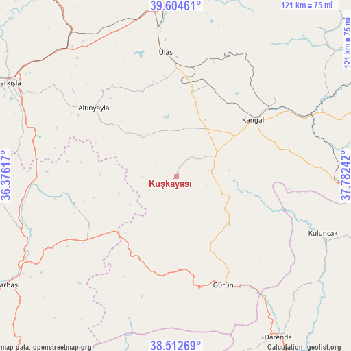
Kuşkayası GPS coordinates[2]
39° 3' 38.736" North, 37° 4' 45.444" East
| Map corner | latitude | longitude |
|---|---|---|
| Upper-left | 39.60461°, | 36.37617° |
| Center: | 39.06076°, | 37.07929° |
| Lower-right: | 38.51269°, | 37.78242° |
| Map W x H: | 121.4×121.4 km | = 75.4×75.4mi |
| max Lat: | 42.02683° ⇑44.6% North |
| Kuşkayası: | 39.06076° |
| min Lat: | ⇓55.4% South 35.9025° |
| min Long | Kuşkayası | max Long |
| 25.90902° | 37.07929° | 44.60099° |
| W 56.9%⇐ | ⇒43.1% E |
Elevation
Elevation of Kuşkayası is 1589 m = 5213 ft, and this is 871.6 m = 2860 ft above average elevation for this country.
| Max E: |
2682 m = 8799 ft | 6.8% |
| Kuşkayası | 1589 m 5213 ft | |
| Avg. | 717.4 m = 2354 ft | |
Min E: |
0 m = 0 ft | 93.2% |
See also: Turkey elevation on elevation.city.
Geographical zone
Kuşkayası is located in North temperate zone (between Tropic of Cancer and the Arctic Circle). Distance of this Northern Tropic circle is 1737.2 km =1079.4 mi to South.| Distance of | km | miles | from Kuşkayası |
|---|---|---|---|
| North Pole | 5663.9 | 3519.4 | to North |
| Arctic Circle | 3058 | 1900.2 | to North |
| Tropic Cancer | 1737.2 | 1079.4 | to South |
| Equator | 4343.1 | 2698.7 | to South |


Nearby cities:
15 places around Kuşkayası: (largest is in red/bold)
• Alacahan
43.1 km =26.8 mi,  83°
83°
• Altınyayla
36.8 km =22.9 mi,  309°
309°
• Deliktaş
33 km =20.5 mi,  18°
18°
• Gürün
41.1 km =25.5 mi,  156°
156°
• Kangal
33 km =20.5 mi,  54°
54°
• Kavak
43.1 km =26.8 mi, 53°
• Kayadibi
56.3 km =35 mi,  325°
325°
• Kaynar
56.9 km =35.4 mi,  251°
251°
• Konakpınar
25.5 km =15.8 mi,  132°
132°
• Kuluncak
54.4 km =33.8 mi,  112°
112°
• Ulaş
42.9 km =26.7 mi,  355°
355°
• Yazyurdu
31.7 km =19.7 mi,  203°
203°
• Çetinkaya
52.2 km =32.4 mi,  64°
64°
• Örenşehir
37.8 km =23.5 mi,  259°
259°
• Şarkışla
66.1 km =41.1 mi,  299°
299°
Sources, notices
• [Note1] Compared only with cities in Turkey existing in our database
• [Src1] Map data: © OpenStreetMap contributors (CC-BY-SA)
• [Src2] Other city data from geonames.org with taken over terms of usage.
• [Src3] Geographical zone / Annual Mean Temperature by Robert A. Rohde @ Wikipedia
