Gürün geodata
Gürün (Sivas) is a seat of a second-order administrative division; located in Turkey in Europe/Istanbul (GMT+3) time zone. With population of 12,715 people, there are 438 cities with bigger population in this country. Compared to other cities in Turkey, 50.4% of cities are located further ↓South; 57.6% of cities are located further ←West and 86% of cities have lower elevation than Gürün. Note1


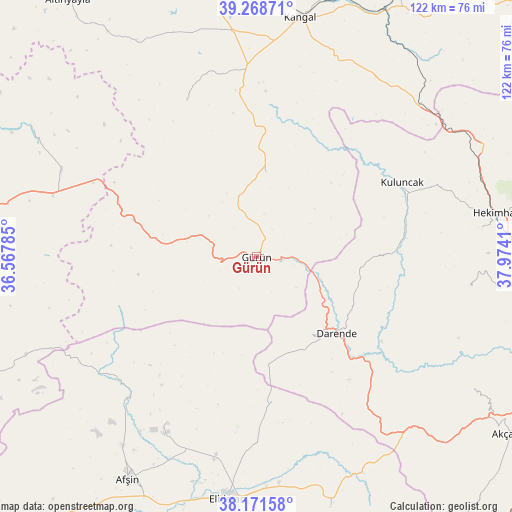
Gürün GPS coordinates[2]
38° 43' 20.1" North, 37° 16' 15.492" East
| Map corner | latitude | longitude |
|---|---|---|
| Upper-left | 39.26871°, | 36.56785° |
| Center: | 38.72225°, | 37.27097° |
| Lower-right: | 38.17158°, | 37.9741° |
| Map W x H: | 122×122 km | = 75.8×75.8mi |
| max Lat: | 42.02683° ⇑49.6% North |
| Gürün: | 38.72225° |
| min Lat: | ⇓50.4% South 35.9025° |
| min Long | Gürün | max Long |
| 25.90902° | 37.27097° | 44.60099° |
| W 57.6%⇐ | ⇒42.4% E |
Elevation
Elevation of Gürün is 1335 m = 4380 ft, and this is 617.6 m = 2026 ft above average elevation for this country.
| Max E: |
2682 m = 8799 ft | 14% |
| Gürün | 1335 m 4380 ft | |
| Avg. | 717.4 m = 2354 ft | |
Min E: |
0 m = 0 ft | 86% |
See also: Turkey elevation on elevation.city.
Geographical zone
Gürün is located in North temperate zone (between Tropic of Cancer and the Arctic Circle). Distance of this Northern Tropic circle is 1699.6 km =1056.1 mi to South.| Distance of | km | miles | from Gürün |
|---|---|---|---|
| North Pole | 5701.6 | 3542.8 | to North |
| Arctic Circle | 3095.7 | 1923.6 | to North |
| Tropic Cancer | 1699.6 | 1056.1 | to South |
| Equator | 4305.5 | 2675.3 | to South |


Nearby cities:
15 places around Gürün: (largest is in red/bold)
• Alacahan
50.2 km =31.2 mi,  31°
31°
• Balaban
39.5 km =24.5 mi,  137°
137°
• Darende
28.3 km =17.6 mi,  133°
133°
• Elbistan
57.8 km =35.9 mi,  186°
186°
• Hasançelebi
58.6 km =36.4 mi,  64°
64°
• Hekimhan
58 km =36 mi,  79°
79°
• Kangal
57.8 km =35.9 mi,  10°
10°
• Konakpınar
20.5 km =12.7 mi, 6°
• Kuluncak
38 km =23.6 mi, 63°
• Kurşunlu
50.9 km =31.6 mi,  98°
98°
• Kuşkayası
41.1 km =25.5 mi,  336°
336°
• Kürecik
59.3 km =36.8 mi, 136°
• Levent
59.8 km =37.2 mi,  122°
122°
• Tanır
45.9 km =28.5 mi,  222°
222°
• Yazyurdu
30.6 km =19 mi,  286°
286°
Sources, notices
• [Note1] Compared only with cities in Turkey existing in our database
• [Src1] Map data: © OpenStreetMap contributors (CC-BY-SA)
• [Src2] Other city data from geonames.org with taken over terms of usage.
• [Src3] Geographical zone / Annual Mean Temperature by Robert A. Rohde @ Wikipedia
