Göçbeyli geodata
Göçbeyli (İzmir) is a seat of a third-order administrative division; located in Turkey in Europe/Istanbul (GMT+3) time zone. In our database, there are 1323 cities with bigger population. Compared to other cities in Turkey, 57.7% of cities are located further ↓South; 94.1% of cities are located further →East and 83.1% of cities have higher elevation than Göçbeyli. Note1


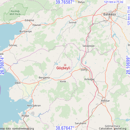
Göçbeyli GPS coordinates[2]
39° 13' 23.808" North, 27° 24' 13.896" East
| Map corner | latitude | longitude |
|---|---|---|
| Upper-left | 39.76587°, | 26.70074° |
| Center: | 39.22328°, | 27.40386° |
| Lower-right: | 38.67647°, | 28.10699° |
| Map W x H: | 121.1×121.1 km | = 75.2×75.2mi |
| max Lat: | 42.02683° ⇑42.3% North |
| Göçbeyli: | 39.22328° |
| min Lat: | ⇓57.7% South 35.9025° |
| min Long | Göçbeyli | max Long |
| 25.90902° | 27.40386° | 44.60099° |
| W 5.9%⇐ | ⇒94.1% E |
Elevation
Elevation of Göçbeyli is 85 m = 279 ft, and this is 632.4 m = 2075 ft below average elevation for this country.
| Max E: |
2682 m = 8799 ft | 83.1% |
| Avg. | 717.4 m = 2354 ft | |
| Göçbeyli | 85 m = 279 ft | |
Min E: |
0 m = 0 ft | 16.9% |
See also: Turkey elevation on elevation.city.
Geographical zone
Göçbeyli is located in North temperate zone (between Tropic of Cancer and the Arctic Circle). Distance of this Northern Tropic circle is 1755.3 km =1090.7 mi to South.| Distance of | km | miles | from Göçbeyli |
|---|---|---|---|
| North Pole | 5645.8 | 3508.1 | to North |
| Arctic Circle | 3040 | 1889 | to North |
| Tropic Cancer | 1755.3 | 1090.7 | to South |
| Equator | 4361.2 | 2709.9 | to South |


Nearby cities:
15 places around Göçbeyli: (largest is in red/bold)
• Bergama
22.4 km =13.9 mi,  239°
239°
• Gelembe
38.6 km =24 mi,  97°
97°
• Kayapa
30.2 km =18.8 mi,  6°
6°
• Korucu
27.7 km =17.2 mi,  353°
353°
• Kozak
27.2 km =16.9 mi,  276°
276°
• Kınık
15.2 km =9.4 mi,  186°
186°
• Kırkağaç
26.3 km =16.3 mi,  119°
119°
• Sarıbeyler
24.5 km =15.2 mi,  37°
37°
• Savaştepe
28.1 km =17.5 mi,  50°
50°
• Soma
18.2 km =11.3 mi, 103°
• Turanlı
9.1 km =5.7 mi,  311°
311°
• Yuntdağ
36.3 km =22.6 mi,  206°
206°
• Zeytindağ
40.4 km =25.1 mi,  225°
225°
• Zeytinliova
34.9 km =21.7 mi,  137°
137°
• İvrindi
40.7 km =25.3 mi, 10°
Sources, notices
• [Note1] Compared only with cities in Turkey existing in our database
• [Src1] Map data: © OpenStreetMap contributors (CC-BY-SA)
• [Src2] Other city data from geonames.org with taken over terms of usage.
• [Src3] Geographical zone / Annual Mean Temperature by Robert A. Rohde @ Wikipedia
