Çelebi geodata
Çelebi (Kırıkkale) is a seat of a second-order administrative division; located in Turkey in Europe/Istanbul (GMT+3) time zone. In our database, there are 1323 cities with bigger population. Compared to other cities in Turkey, 60.8% of cities are located further ↓South; 60.2% of cities are located further →East and 82.5% of cities have lower elevation than Çelebi. Note1


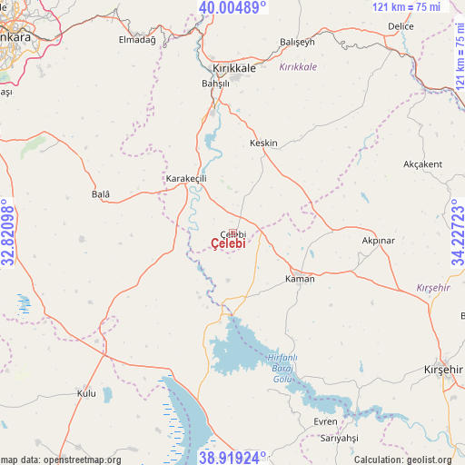
Çelebi GPS coordinates[2]
39° 27' 51.048" North, 33° 31' 26.76" East
| Map corner | latitude | longitude |
|---|---|---|
| Upper-left | 40.00489°, | 32.82098° |
| Center: | 39.46418°, | 33.5241° |
| Lower-right: | 38.91924°, | 34.22723° |
| Map W x H: | 120.7×120.7 km | = 75×75mi |
| max Lat: | 42.02683° ⇑39.2% North |
| Çelebi: | 39.46418° |
| min Lat: | ⇓60.8% South 35.9025° |
| min Long | Çelebi | max Long |
| 25.90902° | 33.5241° | 44.60099° |
| W 39.8%⇐ | ⇒60.2% E |
Elevation
Elevation of Çelebi is 1247 m = 4091 ft, and this is 529.6 m = 1738 ft above average elevation for this country.
| Max E: |
2682 m = 8799 ft | 17.5% |
| Çelebi | 1247 m 4091 ft | |
| Avg. | 717.4 m = 2354 ft | |
Min E: |
0 m = 0 ft | 82.5% |
See also: Turkey elevation on elevation.city.
Geographical zone
Çelebi is located in North temperate zone (between Tropic of Cancer and the Arctic Circle). Distance of this Northern Tropic circle is 1782.1 km =1107.3 mi to South.| Distance of | km | miles | from Çelebi |
|---|---|---|---|
| North Pole | 5619.1 | 3491.5 | to North |
| Arctic Circle | 3013.2 | 1872.3 | to North |
| Tropic Cancer | 1782.1 | 1107.3 | to South |
| Equator | 4388 | 2726.6 | to South |


Nearby cities:
15 places around Çelebi: (largest is in red/bold)
• Akpınar
37.9 km =23.5 mi,  92°
92°
• Akçakent
52.1 km =32.4 mi,  70°
70°
• Bahşılı
38.1 km =23.7 mi,  348°
348°
• Bala
35.8 km =22.2 mi,  286°
286°
• Balışeyh
52.9 km =32.9 mi,  18°
18°
• Elmadağ
56.6 km =35.2 mi,  333°
333°
• Evren
54.6 km =33.9 mi,  153°
153°
• Kaman
20.9 km =13 mi,  124°
124°
• Karakeçili
19.1 km =11.9 mi,  319°
319°
• Keskin
24.5 km =15.2 mi, 18°
• Kulu
56.1 km =34.9 mi,  222°
222°
• Kösefakılı
54.4 km =33.8 mi, 74°
• Kırıkkale
42.4 km =26.3 mi,  357°
357°
• Savcılı
29.5 km =18.3 mi, 152°
• Yahşihan
43.4 km =27 mi, 351°
Sources, notices
• [Note1] Compared only with cities in Turkey existing in our database
• [Src1] Map data: © OpenStreetMap contributors (CC-BY-SA)
• [Src2] Other city data from geonames.org with taken over terms of usage.
• [Src3] Geographical zone / Annual Mean Temperature by Robert A. Rohde @ Wikipedia
