Savcılı geodata
Savcılı (Kırşehir) is a seat of a third-order administrative division; located in Turkey in Europe/Istanbul (GMT+3) time zone. In our database, there are 1323 cities with bigger population. Compared to other cities in Turkey, 58% of cities are located further ↓South; 59.7% of cities are located further →East and 63.2% of cities have lower elevation than Savcılı. Note1


Savcılı GPS coordinates[2]
39° 13' 44.004" North, 33° 40' 53.004" East
| Map corner | latitude | longitude |
|---|---|---|
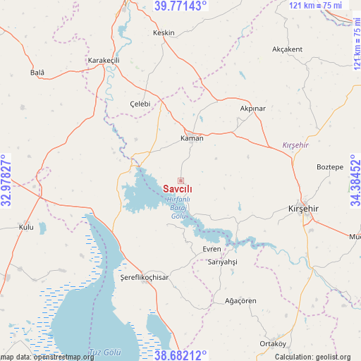
| Upper-left | 39.77143°, | 32.97827° |
| Center: | 39.22889°, | 33.68139° |
| Lower-right: | 38.68212°, | 34.38452° |
| Map W x H: | 121.1×121.1 km | = 75.2×75.2mi |
| max Lat: | 42.02683° ⇑42% North |
| Savcılı: | 39.22889° |
| min Lat: | ⇓58% South 35.9025° |
| min Long | Savcılı | max Long |
| 25.90902° | 33.68139° | 44.60099° |
| W 40.3%⇐ | ⇒59.7% E |
Elevation
Elevation of Savcılı is 932 m = 3058 ft, and this is 214.6 m = 704 ft above average elevation for this country.
| Max E: |
2682 m = 8799 ft | 36.8% |
| Savcılı | 932 m 3058 ft | |
| Avg. | 717.4 m = 2354 ft | |
Min E: |
0 m = 0 ft | 63.2% |
See also: Turkey elevation on elevation.city.
Geographical zone
Savcılı is located in North temperate zone (between Tropic of Cancer and the Arctic Circle). Distance of this Northern Tropic circle is 1755.9 km =1091.1 mi to South.| Distance of | km | miles | from Savcılı |
|---|---|---|---|
| North Pole | 5645.2 | 3507.8 | to North |
| Arctic Circle | 3039.3 | 1888.5 | to North |
| Tropic Cancer | 1755.9 | 1091.1 | to South |
| Equator | 4361.8 | 2710.3 | to South |


Nearby cities:
15 places around Savcılı: (largest is in red/bold)
• Akpınar
34.6 km =21.5 mi,  44°
44°
• Akçakent
56.4 km =35 mi, 39°
• Ağaçören
44.3 km =27.5 mi,  152°
152°
• Boztepe
50.1 km =31.1 mi,  84°
84°
• Evren
25.2 km =15.7 mi, 154°
• Göllü
58.6 km =36.4 mi,  65°
65°
• Kaman
14.8 km =9.2 mi,  14°
14°
• Karakeçili
48.3 km =30 mi,  327°
327°
• Keskin
49.7 km =30.9 mi,  353°
353°
• Kulu
53.9 km =33.5 mi,  253°
253°
• Kösefakılı
56.3 km =35 mi, 43°
• Kırşehir
42.6 km =26.5 mi,  102°
102°
• Sarıyahşi
30.6 km =19 mi, 153°
• Çelebi
29.5 km =18.3 mi, 332°
• Şereflikoçhisar
34.5 km =21.4 mi,  200°
200°
Sources, notices
• [Note1] Compared only with cities in Turkey existing in our database
• [Src1] Map data: © OpenStreetMap contributors (CC-BY-SA)
• [Src2] Other city data from geonames.org with taken over terms of usage.
• [Src3] Geographical zone / Annual Mean Temperature by Robert A. Rohde @ Wikipedia
