Evren geodata
Evren (Ankara) is a seat of a second-order administrative division; located in Turkey in Europe/Istanbul (GMT+3) time zone. In our database, there are 1323 cities with bigger population. Compared to other cities in Turkey, 54.8% of cities are located further ↓South; 59.1% of cities are located further →East and 60.7% of cities have lower elevation than Evren. Note1


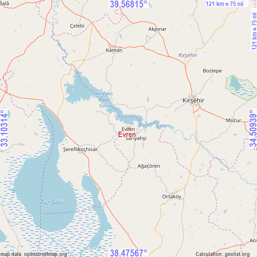
Evren GPS coordinates[2]
39° 1' 26.472" North, 33° 48' 22.536" East
| Map corner | latitude | longitude |
|---|---|---|
| Upper-left | 39.56815°, | 33.10314° |
| Center: | 39.02402°, | 33.80626° |
| Lower-right: | 38.47567°, | 34.50939° |
| Map W x H: | 121.5×121.5 km | = 75.5×75.5mi |
| max Lat: | 42.02683° ⇑45.2% North |
| Evren: | 39.02402° |
| min Lat: | ⇓54.8% South 35.9025° |
| min Long | Evren | max Long |
| 25.90902° | 33.80626° | 44.60099° |
| W 40.9%⇐ | ⇒59.1% E |
Elevation
Elevation of Evren is 895 m = 2936 ft, and this is 177.6 m = 583 ft above average elevation for this country.
| Max E: |
2682 m = 8799 ft | 39.3% |
| Evren | 895 m 2936 ft | |
| Avg. | 717.4 m = 2354 ft | |
Min E: |
0 m = 0 ft | 60.7% |
See also: Turkey elevation on elevation.city.
Geographical zone
Evren is located in North temperate zone (between Tropic of Cancer and the Arctic Circle). Distance of this Northern Tropic circle is 1733.1 km =1076.9 mi to South.| Distance of | km | miles | from Evren |
|---|---|---|---|
| North Pole | 5668 | 3521.9 | to North |
| Arctic Circle | 3062.1 | 1902.7 | to North |
| Tropic Cancer | 1733.1 | 1076.9 | to South |
| Equator | 4339.1 | 2696.2 | to South |


Nearby cities:
15 places around Evren: (largest is in red/bold)
• Acıpınar
55.4 km =34.4 mi,  175°
175°
• Akpınar
49.3 km =30.6 mi,  16°
16°
• Ağaçören
19.1 km =11.9 mi,  150°
150°
• Balcı
41.9 km =26 mi,  142°
142°
• Boztepe
47.8 km =29.7 mi,  55°
55°
• Göllü
63.6 km =39.5 mi,  41°
41°
• Kaman
37.8 km =23.5 mi,  349°
349°
• Kulu
63.2 km =39.3 mi,  277°
277°
• Kırşehir
33.7 km =20.9 mi,  66°
66°
• Mucur
50 km =31.1 mi,  85°
85°
• Ortaköy
37.7 km =23.4 mi, 147°
• Sarıyahşi
5.4 km =3.4 mi, 146°
• Savcılı
25.2 km =15.7 mi,  334°
334°
• Çelebi
54.6 km =33.9 mi, 333°
• Şereflikoçhisar
25 km =15.5 mi,  247°
247°
Sources, notices
• [Note1] Compared only with cities in Turkey existing in our database
• [Src1] Map data: © OpenStreetMap contributors (CC-BY-SA)
• [Src2] Other city data from geonames.org with taken over terms of usage.
• [Src3] Geographical zone / Annual Mean Temperature by Robert A. Rohde @ Wikipedia
