Çamlıdere geodata
Çamlıdere (Şanlıurfa) is a seat of a third-order administrative division; located in Turkey in Europe/Istanbul (GMT+3) time zone. In our database, there are 1323 cities with bigger population. Compared to other cities in Turkey, 85.2% of cities are located further ↑North; 68.4% of cities are located further ←West and 62.2% of cities have higher elevation than Çamlıdere. Note1


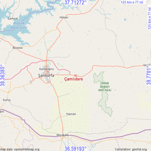
Çamlıdere GPS coordinates[2]
37° 9' 15.84" North, 39° 4' 1.092" East
| Map corner | latitude | longitude |
|---|---|---|
| Upper-left | 37.71272°, | 38.36385° |
| Center: | 37.1544°, | 39.06697° |
| Lower-right: | 36.59193°, | 39.7701° |
| Map W x H: | 124.6×124.6 km | = 77.4×77.4mi |
| max Lat: | 42.02683° ⇑85.2% North |
| Çamlıdere: | 37.1544° |
| min Lat: | ⇓14.8% South 35.9025° |
| min Long | Çamlıdere | max Long |
| 25.90902° | 39.06697° | 44.60099° |
| W 68.4%⇐ | ⇒31.6% E |
Elevation
Elevation of Çamlıdere is 469 m = 1539 ft, and this is 248.4 m = 815 ft below average elevation for this country.
| Max E: |
2682 m = 8799 ft | 62.2% |
| Avg. | 717.4 m = 2354 ft | |
| Çamlıdere | 469 m = 1539 ft | |
Min E: |
0 m = 0 ft | 37.8% |
See also: Turkey elevation on elevation.city.
Geographical zone
Çamlıdere is located in North temperate zone (between Tropic of Cancer and the Arctic Circle). Distance of this Northern Tropic circle is 1525.3 km =947.8 mi to South.| Distance of | km | miles | from Çamlıdere |
|---|---|---|---|
| North Pole | 5875.9 | 3651.1 | to North |
| Arctic Circle | 3270 | 2031.9 | to North |
| Tropic Cancer | 1525.3 | 947.8 | to South |
| Equator | 4131.2 | 2567 | to South |


Nearby cities:
15 places around Çamlıdere: (largest is in red/bold)
• Balkat
32.5 km =20.2 mi,  191°
191°
• Eskiharran
24.9 km =15.5 mi,  181°
181°
• Kabahaydar
18.4 km =11.4 mi,  344°
344°
• Kabahaydar
27.3 km =17 mi,  3°
3°
• Karaköprü
24.3 km =15.1 mi,  282°
282°
• Keçikıran
22.2 km =13.8 mi,  199°
199°
• Minare
25.5 km =15.8 mi, 192°
• Ozanlar
27.7 km =17.2 mi,  212°
212°
• Parapara
25.4 km =15.8 mi, 205°
• Seksenören
20.2 km =12.6 mi, 178°
• Yardımcı
15.8 km =9.8 mi, 200°
• Yağmurlu
29.8 km =18.5 mi,  125°
125°
• Yediyol
21.8 km =13.5 mi, 213°
• Örenlı
27.2 km =16.9 mi,  136°
136°
• Şanlıurfa
24.2 km =15 mi,  273°
273°
Sources, notices
• [Note1] Compared only with cities in Turkey existing in our database
• [Src1] Map data: © OpenStreetMap contributors (CC-BY-SA)
• [Src2] Other city data from geonames.org with taken over terms of usage.
• [Src3] Geographical zone / Annual Mean Temperature by Robert A. Rohde @ Wikipedia
