Altınekin geodata
Altınekin (Konya) is a seat of a second-order administrative division; located in Turkey in Europe/Istanbul (GMT+3) time zone. With population of 13,090 people, there are 420 cities with bigger population in this country. Compared to other cities in Turkey, 56.1% of cities are located further ↑North; 62.7% of cities are located further →East and 66.9% of cities have lower elevation than Altınekin. Note1


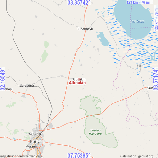
Altınekin GPS coordinates[2]
38° 18' 28.008" North, 32° 52' 6.996" East
| Map corner | latitude | longitude |
|---|---|---|
| Upper-left | 38.85742°, | 32.16549° |
| Center: | 38.30778°, | 32.86861° |
| Lower-right: | 37.75395°, | 33.57174° |
| Map W x H: | 122.7×122.7 km | = 76.2×76.2mi |
| max Lat: | 42.02683° ⇑56.1% North |
| Altınekin: | 38.30778° |
| min Lat: | ⇓43.9% South 35.9025° |
| min Long | Altınekin | max Long |
| 25.90902° | 32.86861° | 44.60099° |
| W 37.3%⇐ | ⇒62.7% E |
Elevation
Elevation of Altınekin is 985 m = 3232 ft, and this is 267.6 m = 878 ft above average elevation for this country.
| Max E: |
2682 m = 8799 ft | 33.1% |
| Altınekin | 985 m 3232 ft | |
| Avg. | 717.4 m = 2354 ft | |
Min E: |
0 m = 0 ft | 66.9% |
See also: Turkey elevation on elevation.city.
Geographical zone
Altınekin is located in North temperate zone (between Tropic of Cancer and the Arctic Circle). Distance of this Northern Tropic circle is 1653.5 km =1027.4 mi to South.| Distance of | km | miles | from Altınekin |
|---|---|---|---|
| North Pole | 5747.6 | 3571.4 | to North |
| Arctic Circle | 3141.7 | 1952.2 | to North |
| Tropic Cancer | 1653.5 | 1027.4 | to South |
| Equator | 4259.4 | 2646.7 | to South |


Nearby cities:
15 places around Altınekin: (largest is in red/bold)
• Aşağıpınarbaşı
38 km =23.6 mi,  217°
217°
• Cihanbeyli
39.5 km =24.5 mi,  7°
7°
• Eskil
48.6 km =30.2 mi,  77°
77°
• Kadınhanı
57.9 km =36 mi,  262°
262°
• Karatay
57.3 km =35.6 mi,  211°
211°
• Konya
59 km =36.7 mi, 214°
• Kurthasanlı
60.5 km =37.6 mi,  271°
271°
• Kuyulusebil
48.5 km =30.1 mi,  322°
322°
• Obruk
30.5 km =19 mi,  116°
116°
• Sarayönü
40.8 km =25.4 mi, 262°
• Selçuklu
57.5 km =35.7 mi, 214°
• Sille
57.7 km =35.9 mi, 222°
• Sultanhanı
59.8 km =37.2 mi,  96°
96°
• Yarma
55.2 km =34.3 mi,  178°
178°
• Yeniceoba
62.9 km =39.1 mi,  353°
353°
Sources, notices
• [Note1] Compared only with cities in Turkey existing in our database
• [Src1] Map data: © OpenStreetMap contributors (CC-BY-SA)
• [Src2] Other city data from geonames.org with taken over terms of usage.
• [Src3] Geographical zone / Annual Mean Temperature by Robert A. Rohde @ Wikipedia
