Yarma geodata
Yarma (Konya) is a seat of a third-order administrative division; located in Turkey in Europe/Istanbul (GMT+3) time zone. With population of 2,601 people, there are 890 cities with bigger population in this country. Compared to other cities in Turkey, 68.2% of cities are located further ↑North; 62.6% of cities are located further →East and 68.1% of cities have lower elevation than Yarma. Note1


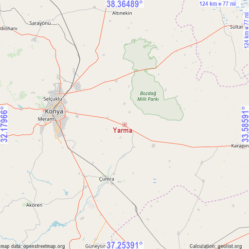
Yarma GPS coordinates[2]
37° 48' 41.364" North, 32° 52' 58.008" East
| Map corner | latitude | longitude |
|---|---|---|
| Upper-left | 38.36489°, | 32.17966° |
| Center: | 37.81149°, | 32.88278° |
| Lower-right: | 37.25391°, | 33.58591° |
| Map W x H: | 123.5×123.5 km | = 76.7×76.7mi |
| max Lat: | 42.02683° ⇑68.2% North |
| Yarma: | 37.81149° |
| min Lat: | ⇓31.8% South 35.9025° |
| min Long | Yarma | max Long |
| 25.90902° | 32.88278° | 44.60099° |
| W 37.4%⇐ | ⇒62.6% E |
Elevation
Elevation of Yarma is 1003 m = 3291 ft, and this is 285.6 m = 937 ft above average elevation for this country.
| Max E: |
2682 m = 8799 ft | 31.9% |
| Yarma | 1003 m 3291 ft | |
| Avg. | 717.4 m = 2354 ft | |
Min E: |
0 m = 0 ft | 68.1% |
See also: Turkey elevation on elevation.city.
Geographical zone
Yarma is located in North temperate zone (between Tropic of Cancer and the Arctic Circle). Distance of this Northern Tropic circle is 1598.3 km =993.1 mi to South.| Distance of | km | miles | from Yarma |
|---|---|---|---|
| North Pole | 5802.8 | 3605.7 | to North |
| Arctic Circle | 3196.9 | 1986.5 | to North |
| Tropic Cancer | 1598.3 | 993.1 | to South |
| Equator | 4204.2 | 2612.4 | to South |


Nearby cities:
15 places around Yarma: (largest is in red/bold)
• Altınekin
55.2 km =34.3 mi,  358°
358°
• Aşağıpınarbaşı
35.3 km =21.9 mi,  315°
315°
• Hatip
41 km =25.5 mi,  261°
261°
• Hatunsaray
53.2 km =33.1 mi,  242°
242°
• Hotamış
42.8 km =26.6 mi,  116°
116°
• Karatay
31.7 km =19.7 mi,  281°
281°
• Konya
35.6 km =22.1 mi, 280°
• Meram
36.5 km =22.7 mi,  273°
273°
• Obruk
49 km =30.4 mi,  32°
32°
• Ovakavağı
12.1 km =7.5 mi,  157°
157°
• Selçuklu
35.2 km =21.9 mi, 283°
• Sille
42.6 km =26.5 mi,  287°
287°
• Çatalhöyük
16.6 km =10.3 mi,  197°
197°
• Çiğil
53.2 km =33.1 mi,  133°
133°
• Çumra
28.2 km =17.5 mi, 199°
Sources, notices
• [Note1] Compared only with cities in Turkey existing in our database
• [Src1] Map data: © OpenStreetMap contributors (CC-BY-SA)
• [Src2] Other city data from geonames.org with taken over terms of usage.
• [Src3] Geographical zone / Annual Mean Temperature by Robert A. Rohde @ Wikipedia
