Aşağıpınarbaşı geodata
Aşağıpınarbaşı (Konya) is a seat of a third-order administrative division; located in Turkey in Europe/Istanbul (GMT+3) time zone. In our database, there are 1323 cities with bigger population. Compared to other cities in Turkey, 60.7% of cities are located further ↑North; 64.1% of cities are located further →East and 68.2% of cities have lower elevation than Aşağıpınarbaşı. Note1


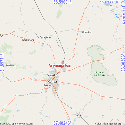
Aşağıpınarbaşı GPS coordinates[2]
38° 2' 17.988" North, 32° 36' 2.988" East
| Map corner | latitude | longitude |
|---|---|---|
| Upper-left | 38.59001°, | 31.89771° |
| Center: | 38.03833°, | 32.60083° |
| Lower-right: | 37.48246°, | 33.30396° |
| Map W x H: | 123.1×123.1 km | = 76.5×76.5mi |
| max Lat: | 42.02683° ⇑60.7% North |
| Aşağıpınarbaşı: | 38.03833° |
| min Lat: | ⇓39.3% South 35.9025° |
| min Long | Aşağıpınarb | max Long |
| 25.90902° | 32.60083° | 44.60099° |
| W 35.9%⇐ | ⇒64.1% E |
Elevation
Elevation of Aşağıpınarbaşı is 1004 m = 3294 ft, and this is 286.6 m = 940 ft above average elevation for this country.
| Max E: |
2682 m = 8799 ft | 31.8% |
| Aşağıpınarbaşı | 1004 m 3294 ft | |
| Avg. | 717.4 m = 2354 ft | |
Min E: |
0 m = 0 ft | 68.2% |
See also: Turkey elevation on elevation.city.
Geographical zone
Aşağıpınarbaşı is located in North temperate zone (between Tropic of Cancer and the Arctic Circle). Distance of this Northern Tropic circle is 1623.5 km =1008.8 mi to South.| Distance of | km | miles | from Aşağıpınarbaşı |
|---|---|---|---|
| North Pole | 5777.6 | 3590 | to North |
| Arctic Circle | 3171.7 | 1970.8 | to North |
| Tropic Cancer | 1623.5 | 1008.8 | to South |
| Equator | 4229.5 | 2628.1 | to South |


Nearby cities:
15 places around Aşağıpınarbaşı: (largest is in red/bold)
• Altınekin
38 km =23.6 mi,  37°
37°
• Derbent
51.3 km =31.9 mi,  267°
267°
• Hatip
35.2 km =21.9 mi,  206°
206°
• Kadınhanı
40.8 km =25.4 mi,  303°
303°
• Karatay
20 km =12.4 mi,  198°
198°
• Konya
21.2 km =13.2 mi, 208°
• Kurthasanlı
49.1 km =30.5 mi,  310°
310°
• Kızılören
46.5 km =28.9 mi,  246°
246°
• Meram
26 km =16.2 mi, 206°
• Ovakavağı
46.8 km =29.1 mi,  141°
141°
• Sarayönü
30.2 km =18.8 mi,  325°
325°
• Selçuklu
19.6 km =12.2 mi, 209°
• Sille
20.1 km =12.5 mi,  232°
232°
• Yarma
35.3 km =21.9 mi, 135°
• Çatalhöyük
45.7 km =28.4 mi,  154°
154°
Sources, notices
• [Note1] Compared only with cities in Turkey existing in our database
• [Src1] Map data: © OpenStreetMap contributors (CC-BY-SA)
• [Src2] Other city data from geonames.org with taken over terms of usage.
• [Src3] Geographical zone / Annual Mean Temperature by Robert A. Rohde @ Wikipedia
