Akçaova geodata
Akçaova (Aydın) is a seat of a third-order administrative division; located in Turkey in Europe/Istanbul (GMT+3) time zone. In our database, there are 1323 cities with bigger population. Compared to other cities in Turkey, 74.6% of cities are located further ↑North; 90% of cities are located further →East and 70.9% of cities have higher elevation than Akçaova. Note1


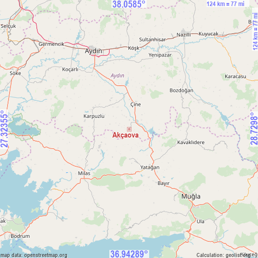
Akçaova GPS coordinates[2]
37° 30' 10.008" North, 28° 1' 36.012" East
| Map corner | latitude | longitude |
|---|---|---|
| Upper-left | 38.0585°, | 27.32355° |
| Center: | 37.50278°, | 28.02667° |
| Lower-right: | 36.94289°, | 28.7298° |
| Map W x H: | 124×124 km | = 77.1×77.1mi |
| max Lat: | 42.02683° ⇑74.6% North |
| Akçaova: | 37.50278° |
| min Lat: | ⇓25.4% South 35.9025° |
| min Long | Akçaova | max Long |
| 25.90902° | 28.02667° | 44.60099° |
| W 10%⇐ | ⇒90% E |
Elevation
Elevation of Akçaova is 263 m = 863 ft, and this is 454.4 m = 1491 ft below average elevation for this country.
| Max E: |
2682 m = 8799 ft | 70.9% |
| Avg. | 717.4 m = 2354 ft | |
| Akçaova | 263 m = 863 ft | |
Min E: |
0 m = 0 ft | 29.1% |
See also: Turkey elevation on elevation.city.
Geographical zone
Akçaova is located in North temperate zone (between Tropic of Cancer and the Arctic Circle). Distance of this Northern Tropic circle is 1564 km =971.8 mi to South.| Distance of | km | miles | from Akçaova |
|---|---|---|---|
| North Pole | 5837.1 | 3627 | to North |
| Arctic Circle | 3231.3 | 2007.8 | to North |
| Tropic Cancer | 1564 | 971.8 | to South |
| Equator | 4169.9 | 2591.1 | to South |


Nearby cities:
15 places around Akçaova: (largest is in red/bold)
• Bayır
31.1 km =19.3 mi,  147°
147°
• Bozarmut
25 km =15.5 mi, 149°
• Bozdoğan
31.5 km =19.6 mi,  53°
53°
• Dalama
32.2 km =20 mi,  6°
6°
• Karpuzlu
18 km =11.2 mi,  290°
290°
• Kavaklıdere
30.4 km =18.9 mi,  102°
102°
• Köşk
39 km =24.2 mi,  3°
3°
• Milas
29.8 km =18.5 mi,  225°
225°
• Selimiye
34.7 km =21.6 mi,  250°
250°
• Tepecik
38.1 km =23.7 mi,  339°
339°
• Turgut
14.2 km =8.8 mi,  178°
178°
• Yatağan
20.8 km =12.9 mi, 150°
• Yenipazar
38.6 km =24 mi,  22°
22°
• Çakırbeyli
31.4 km =19.5 mi,  325°
325°
• Çine
12.5 km =7.8 mi, 13°
Sources, notices
• [Note1] Compared only with cities in Turkey existing in our database
• [Src1] Map data: © OpenStreetMap contributors (CC-BY-SA)
• [Src2] Other city data from geonames.org with taken over terms of usage.
• [Src3] Geographical zone / Annual Mean Temperature by Robert A. Rohde @ Wikipedia
