Tosya geodata
Tosya (Kastamonu) is a seat of a second-order administrative division; located in Turkey in Europe/Istanbul (GMT+3) time zone. With population of 24,013 people, there are 294 cities with bigger population in this country. Compared to other cities in Turkey, 89.5% of cities are located further ↓South; 58.2% of cities are located further →East and 56.7% of cities have lower elevation than Tosya. Note1


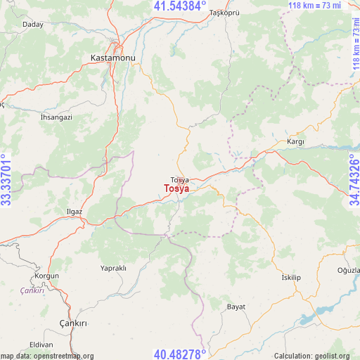
Tosya GPS coordinates[2]
41° 0' 55.62" North, 34° 2' 24.468" East
| Map corner | latitude | longitude |
|---|---|---|
| Upper-left | 41.54384°, | 33.33701° |
| Center: | 41.01545°, | 34.04013° |
| Lower-right: | 40.48278°, | 34.74326° |
| Map W x H: | 118×118 km | = 73.3×73.3mi |
| max Lat: | 42.02683° ⇑10.5% North |
| Tosya: | 41.01545° |
| min Lat: | ⇓89.5% South 35.9025° |
| min Long | Tosya | max Long |
| 25.90902° | 34.04013° | 44.60099° |
| W 41.8%⇐ | ⇒58.2% E |
Elevation
Elevation of Tosya is 823 m = 2700 ft, and this is 105.6 m = 346 ft above average elevation for this country.
| Max E: |
2682 m = 8799 ft | 43.3% |
| Tosya | 823 m 2700 ft | |
| Avg. | 717.4 m = 2354 ft | |
Min E: |
0 m = 0 ft | 56.7% |
See also: Turkey elevation on elevation.city.
Geographical zone
Tosya is located in North temperate zone (between Tropic of Cancer and the Arctic Circle). Distance of this Northern Tropic circle is 1954.6 km =1214.5 mi to South.| Distance of | km | miles | from Tosya |
|---|---|---|---|
| North Pole | 5446.6 | 3384.4 | to North |
| Arctic Circle | 2840.7 | 1765.1 | to North |
| Tropic Cancer | 1954.6 | 1214.5 | to South |
| Equator | 4560.5 | 2833.8 | to South |


Nearby cities:
15 places around Tosya: (largest is in red/bold)
• Akkaya
51.7 km =32.1 mi,  295°
295°
• Bayat
45.1 km =28 mi,  155°
155°
• Belören
48.8 km =30.3 mi,  249°
249°
• Hacıhamza
34.9 km =21.7 mi,  79°
79°
• Ilgaz
36.2 km =22.5 mi, 253°
• Kargı
39.7 km =24.7 mi,  70°
70°
• Kastamonu
46 km =28.6 mi,  331°
331°
• Khanjarah
58.4 km =36.3 mi,  217°
217°
• Korgun
53.8 km =33.4 mi,  234°
234°
• Kuzyaka
35.9 km =22.3 mi,  312°
312°
• Taşköprü
56.9 km =35.4 mi,  14°
14°
• Yapraklı
36.1 km =22.4 mi, 217°
• İhsangazi
45.8 km =28.5 mi, 297°
• İkizören
38.7 km =24 mi,  199°
199°
• İskilip
48 km =29.8 mi,  130°
130°
Sources, notices
• [Note1] Compared only with cities in Turkey existing in our database
• [Src1] Map data: © OpenStreetMap contributors (CC-BY-SA)
• [Src2] Other city data from geonames.org with taken over terms of usage.
• [Src3] Geographical zone / Annual Mean Temperature by Robert A. Rohde @ Wikipedia
