Boyalıca geodata
Boyalıca (Bursa) is a populated place; located in Turkey in Europe/Istanbul (GMT+3) time zone. With population of 2,227 people, there are 918 cities with bigger population in this country. Compared to other cities in Turkey, 77.3% of cities are located further ↓South; 79% of cities are located further →East and 82.3% of cities have higher elevation than Boyalıca. Note1


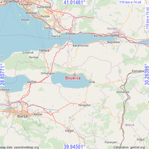
Boyalıca GPS coordinates[2]
40° 28' 54.984" North, 29° 33' 38.988" East
| Map corner | latitude | longitude |
|---|---|---|
| Upper-left | 41.01461°, | 28.85771° |
| Center: | 40.48194°, | 29.56083° |
| Lower-right: | 39.94501°, | 30.26396° |
| Map W x H: | 118.9×118.9 km | = 73.9×73.9mi |
| max Lat: | 42.02683° ⇑22.7% North |
| Boyalıca: | 40.48194° |
| min Lat: | ⇓77.3% South 35.9025° |
| min Long | Boyalıca | max Long |
| 25.90902° | 29.56083° | 44.60099° |
| W 21%⇐ | ⇒79% E |
Elevation
Elevation of Boyalıca is 93 m = 305 ft, and this is 624.4 m = 2049 ft below average elevation for this country.
| Max E: |
2682 m = 8799 ft | 82.3% |
| Avg. | 717.4 m = 2354 ft | |
| Boyalıca | 93 m = 305 ft | |
Min E: |
0 m = 0 ft | 17.7% |
See also: Turkey elevation on elevation.city.
Geographical zone
Boyalıca is located in North temperate zone (between Tropic of Cancer and the Arctic Circle). Distance of this Northern Tropic circle is 1895.3 km =1177.7 mi to South.| Distance of | km | miles | from Boyalıca |
|---|---|---|---|
| North Pole | 5505.9 | 3421.2 | to North |
| Arctic Circle | 2900 | 1802 | to North |
| Tropic Cancer | 1895.3 | 1177.7 | to South |
| Equator | 4501.2 | 2796.9 | to South |


Nearby cities:
15 places around Boyalıca: (largest is in red/bold)
• Balarim
12.3 km =7.6 mi,  168°
168°
• Dereköy
20.3 km =12.6 mi,  0°
0°
• Dırazali
15.7 km =9.8 mi,  127°
127°
• Elbeyli
13.9 km =8.6 mi,  88°
88°
• Narlıca
12.6 km =7.8 mi,  212°
212°
• Orhangazi
21.3 km =13.2 mi,  272°
272°
• Orhaniye
8.8 km =5.5 mi,  72°
72°
• Sölöz
15.7 km =9.8 mi,  231°
231°
• Tacir
15.9 km =9.9 mi, 72°
• Yalakdere
13.8 km =8.6 mi, 0°
• Yeniköy
18.5 km =11.5 mi,  288°
288°
• Çakırca
8.8 km =5.5 mi,  98°
98°
• Çakırlı
10 km =6.2 mi, 293°
• Çukurköy
18.7 km =11.6 mi,  316°
316°
• İznik
14.8 km =9.2 mi,  113°
113°
Sources, notices
• [Note1] Compared only with cities in Turkey existing in our database
• [Src1] Map data: © OpenStreetMap contributors (CC-BY-SA)
• [Src2] Other city data from geonames.org with taken over terms of usage.
• [Src3] Geographical zone / Annual Mean Temperature by Robert A. Rohde @ Wikipedia
