Akdağ geodata
Akdağ (Amasya) is a seat of a third-order administrative division; located in Turkey in Europe/Istanbul (GMT+3) time zone. In our database, there are 1323 cities with bigger population. Compared to other cities in Turkey, 81.4% of cities are located further ↓South; 50% of cities are located further ←West and 63.6% of cities have higher elevation than Akdağ. Note1


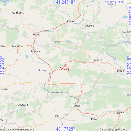
Akdağ GPS coordinates[2]
40° 42' 44.46" North, 35° 58' 33.78" East
| Map corner | latitude | longitude |
|---|---|---|
| Upper-left | 41.24318°, | 35.27293° |
| Center: | 40.71235°, | 35.97605° |
| Lower-right: | 40.17725°, | 36.67918° |
| Map W x H: | 118.5×118.5 km | = 73.6×73.6mi |
| max Lat: | 42.02683° ⇑18.6% North |
| Akdağ: | 40.71235° |
| min Lat: | ⇓81.4% South 35.9025° |
| min Long | Akdağ | max Long |
| 25.90902° | 35.97605° | 44.60099° |
| W 50%⇐ | ⇒50% E |
Elevation
Elevation of Akdağ is 441 m = 1447 ft, and this is 276.4 m = 907 ft below average elevation for this country.
| Max E: |
2682 m = 8799 ft | 63.6% |
| Avg. | 717.4 m = 2354 ft | |
| Akdağ | 441 m = 1447 ft | |
Min E: |
0 m = 0 ft | 36.4% |
See also: Turkey elevation on elevation.city.
Geographical zone
Akdağ is located in North temperate zone (between Tropic of Cancer and the Arctic Circle). Distance of this Northern Tropic circle is 1920.9 km =1193.6 mi to South.| Distance of | km | miles | from Akdağ |
|---|---|---|---|
| North Pole | 5480.3 | 3405.3 | to North |
| Arctic Circle | 2874.4 | 1786.1 | to North |
| Tropic Cancer | 1920.9 | 1193.6 | to South |
| Equator | 4526.8 | 2812.8 | to South |


Nearby cities:
15 places around Akdağ: (largest is in red/bold)
• Amasya
13.7 km =8.5 mi,  241°
241°
• Asarcık
42 km =26.1 mi,  31°
31°
• Destek
23 km =14.3 mi,  49°
49°
• Doğantepe
33.9 km =21.1 mi,  247°
247°
• Esençay
34.4 km =21.4 mi,  98°
98°
• Ezinepazarı
21 km =13 mi,  139°
139°
• Gediksaray
41.9 km =26 mi,  224°
224°
• Havza
39 km =24.2 mi,  317°
317°
• Kavak
41.1 km =25.5 mi,  7°
7°
• Ladik
23.1 km =14.4 mi,  342°
342°
• Suluova
30.6 km =19 mi,  295°
295°
• Taşova
29.7 km =18.5 mi,  79°
79°
• Tekke
18.2 km =11.3 mi,  88°
88°
• Turhal
37.2 km =23.1 mi,  166°
166°
• Şeyhli
24.4 km =15.2 mi,  17°
17°
Sources, notices
• [Note1] Compared only with cities in Turkey existing in our database
• [Src1] Map data: © OpenStreetMap contributors (CC-BY-SA)
• [Src2] Other city data from geonames.org with taken over terms of usage.
• [Src3] Geographical zone / Annual Mean Temperature by Robert A. Rohde @ Wikipedia
