Shinyanga geodata
Shinyanga is a seat of a first-order administrative division; located in Tanzania in Africa/Dar_es_Salaam (GMT+3) time zone. With population of 107,362 people, there are 15 cities with bigger population in this country. Compared to other cities in Tanzania, 73.4% of cities are located further ↓South; 74.8% of cities are located further →East and 50.7% of cities have higher elevation than Shinyanga. Note1


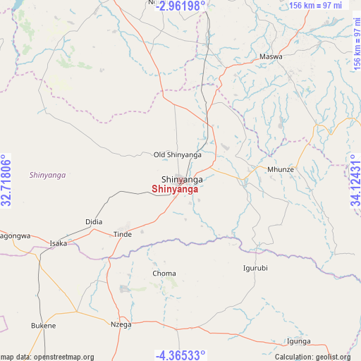
Shinyanga GPS coordinates[2]
3° 39' 50.148" South, 33° 25' 16.248" East
| Map corner | latitude | longitude |
|---|---|---|
| Upper-left | -2.96198°, | 32.71806° |
| Center: | -3.66393°, | 33.42118° |
| Lower-right: | -4.36533°, | 34.12431° |
| Map W x H: | 156×156 km | = 96.9×96.9mi |
| max Lat: | -1.14389° ⇑26.6% North |
| Shinyanga: | -3.66393° |
| min Lat: | ⇓73.4% South -11.36667° |
| min Long | Shinyanga | max Long |
| 29.62667° | 33.42118° | 40.33333° |
| W 25.2%⇐ | ⇒74.8% E |
Elevation
Elevation of Shinyanga is 1133 m = 3717 ft, and this is 190.2 m = 624 ft above average elevation for this country.
| Max E: |
2377 m = 7799 ft | 50.7% |
| Shinyanga | 1133 m 3717 ft | |
| Avg. | 942.8 m = 3093 ft | |
Min E: |
0 m = 0 ft | 49.3% |
See also: Shinyanga elevation on elevation.city.
Geographical zone
Shinyanga is located in South Torrid zone (between Equator and Tropic of Capricorn). Distance of Equator is 407.4 km =253.1 mi to North.| Distance of | km | miles | from Shinyanga |
|---|---|---|---|
| Equator | 407.4 | 253.1 | to North |
| Tropic Capricorn | 2198.5 | 1366.1 | to South |
| Antarctic Circle | 6993.8 | 4345.7 | to South |
| South Pole | 9599.7 | 5965 | to South |


Nearby cities:
15 places around Shinyanga: (largest is in red/bold)
• Igurubi
48.5 km =30.1 mi,  140°
140°
• Isaka
60.2 km =37.4 mi,  244°
244°
• Kishapu
49.7 km =30.9 mi,  83°
83°
• Lalago
63.3 km =39.3 mi,  67°
67°
• Malampaka
60.3 km =37.5 mi,  11°
11°
• Malya
76.4 km =47.5 mi, 7°
• Mhango
76.2 km =47.3 mi,  303°
303°
• Mwadui
23.5 km =14.6 mi,  57°
57°
• Ngudu
78.1 km =48.5 mi,  352°
352°
• Nyalikungu
66.9 km =41.6 mi,  36°
36°
• Nzega
66.9 km =41.6 mi,  203°
203°
• Old Shinyanga
12.9 km =8 mi, 349°
• Somanda
67.4 km =41.9 mi, 60°
• Songwa
19.5 km =12.1 mi,  32°
32°
• Tinde
34.6 km =21.5 mi,  225°
225°
Sources, notices
• [Note1] Compared only with cities in Tanzania existing in our database
• [Src1] Map data: © OpenStreetMap contributors (CC-BY-SA)
• [Src2] Other city data from geonames.org with taken over terms of usage.
• [Src3] Geographical zone / Annual Mean Temperature by Robert A. Rohde @ Wikipedia
