Mungaa geodata
Mungaa (Singida) is a populated place; located in Tanzania in Africa/Dar_es_Salaam (GMT+3) time zone. With population of 16,715 people, there are 169 cities with bigger population in this country. Compared to other cities in Tanzania, 55.6% of cities are located further ↓South; 53.1% of cities are located further →East and 89.9% of cities have lower elevation than Mungaa. Note1


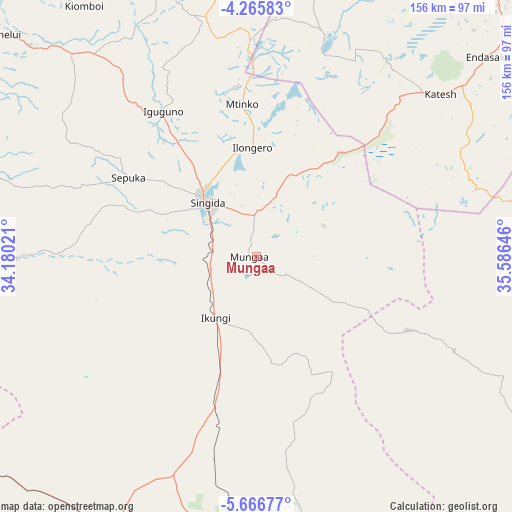
Mungaa GPS coordinates[2]
4° 58' 0.012" South, 34° 52' 59.988" East
| Map corner | latitude | longitude |
|---|---|---|
| Upper-left | -4.26583°, | 34.18021° |
| Center: | -4.96667°, | 34.88333° |
| Lower-right: | -5.66677°, | 35.58646° |
| Map W x H: | 155.8×155.8 km | = 96.8×96.8mi |
| max Lat: | -1.14389° ⇑44.4% North |
| Mungaa: | -4.96667° |
| min Lat: | ⇓55.6% South -11.36667° |
| min Long | Mungaa | max Long |
| 29.62667° | 34.88333° | 40.33333° |
| W 46.9%⇐ | ⇒53.1% E |
Elevation
Elevation of Mungaa is 1608 m = 5276 ft, and this is 665.2 m = 2182 ft above average elevation for this country.
| Max E: |
2377 m = 7799 ft | 10.1% |
| Mungaa | 1608 m 5276 ft | |
| Avg. | 942.8 m = 3093 ft | |
Min E: |
0 m = 0 ft | 89.9% |
See also: Tanzania elevation on elevation.city.
Geographical zone
Mungaa is located in South Torrid zone (between Equator and Tropic of Capricorn). Distance of Equator is 552.2 km =343.1 mi to North.| Distance of | km | miles | from Mungaa |
|---|---|---|---|
| Equator | 552.2 | 343.1 | to North |
| Tropic Capricorn | 2053.7 | 1276.1 | to South |
| Antarctic Circle | 6848.9 | 4255.7 | to South |
| South Pole | 9454.8 | 5874.9 | to South |


Nearby cities:
15 places around Mungaa: (largest is in red/bold)
• Basotu
70.3 km =43.7 mi,  18°
18°
• Endasak
93.1 km =57.8 mi,  48°
48°
• Igugunu
52.4 km =32.6 mi,  328°
328°
• Ikungi
22.6 km =14 mi,  214°
214°
• Ilongero
33.4 km =20.8 mi,  356°
356°
• Itigi
92.8 km =57.7 mi, 208°
• Katesh
74.2 km =46.1 mi, 48°
• Kilimatinde
98.5 km =61.2 mi,  175°
175°
• Kiomboi
96.6 km =60 mi,  323°
323°
• Mtinko
46.5 km =28.9 mi, 355°
• Nangwa
83.9 km =52.1 mi, 48°
• Ndago
71.8 km =44.6 mi,  304°
304°
• Puma
17 km =10.6 mi,  257°
257°
• Sepuka
45.7 km =28.4 mi, 301°
• Singida
22.8 km =14.2 mi, 317°
Sources, notices
• [Note1] Compared only with cities in Tanzania existing in our database
• [Src1] Map data: © OpenStreetMap contributors (CC-BY-SA)
• [Src2] Other city data from geonames.org with taken over terms of usage.
• [Src3] Geographical zone / Annual Mean Temperature by Robert A. Rohde @ Wikipedia
