Kilimatinde geodata
Kilimatinde (Singida) is a populated place; located in Tanzania in Africa/Dar_es_Salaam (GMT+3) time zone. With population of 5,975 people, there are 267 cities with bigger population in this country. Compared to other cities in Tanzania, 53.8% of cities are located further ↑North; 52.4% of cities are located further →East and 54.5% of cities have higher elevation than Kilimatinde. Note1


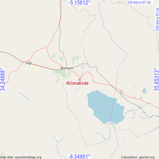
Kilimatinde GPS coordinates[2]
5° 51' 0" South, 34° 57' 0" East
| Map corner | latitude | longitude |
|---|---|---|
| Upper-left | -5.15012°, | 34.24688° |
| Center: | -5.85°, | 34.95° |
| Lower-right: | -6.54901°, | 35.65313° |
| Map W x H: | 155.5×155.5 km | = 96.6×96.6mi |
| max Lat: | -1.14389° ⇑53.8% North |
| Kilimatinde: | -5.85° |
| min Lat: | ⇓46.2% South -11.36667° |
| min Long | Kilimatinde | max Long |
| 29.62667° | 34.95° | 40.33333° |
| W 47.6%⇐ | ⇒52.4% E |
Elevation
Elevation of Kilimatinde is 1085 m = 3560 ft, and this is 142.2 m = 467 ft above average elevation for this country.
| Max E: |
2377 m = 7799 ft | 54.5% |
| Kilimatinde | 1085 m 3560 ft | |
| Avg. | 942.8 m = 3093 ft | |
Min E: |
0 m = 0 ft | 45.5% |
See also: Tanzania elevation on elevation.city.
Geographical zone
Kilimatinde is located in South Torrid zone (between Equator and Tropic of Capricorn). Distance of Equator is 650.5 km =404.2 mi to North.| Distance of | km | miles | from Kilimatinde |
|---|---|---|---|
| Equator | 650.5 | 404.2 | to North |
| Tropic Capricorn | 1955.5 | 1215.1 | to South |
| Antarctic Circle | 6750.7 | 4194.7 | to South |
| South Pole | 9356.6 | 5813.9 | to South |


Nearby cities:
15 places around Kilimatinde: (largest is in red/bold)
• Dodoma
94.4 km =58.7 mi,  112°
112°
• Igugunu
146.9 km =91.3 mi,  346°
346°
• Ikungi
82.2 km =51.1 mi, 345°
• Ilongero
131.9 km =82 mi,  355°
355°
• Itigi
54.3 km =33.7 mi,  287°
287°
• Kintinku
31.6 km =19.6 mi,  96°
96°
• Kisasa
100 km =62.1 mi, 111°
• Kondoa
140.2 km =87.1 mi,  41°
41°
• Mgandu
91 km =56.5 mi,  262°
262°
• Msanga
121.9 km =75.7 mi, 100°
• Mtinko
145 km =90.1 mi, 355°
• Mungaa
98.5 km =61.2 mi, 355°
• Puma
97.5 km =60.6 mi, 345°
• Sepuka
130.7 km =81.2 mi,  339°
339°
• Singida
117.2 km =72.8 mi, 348°
Sources, notices
• [Note1] Compared only with cities in Tanzania existing in our database
• [Src1] Map data: © OpenStreetMap contributors (CC-BY-SA)
• [Src2] Other city data from geonames.org with taken over terms of usage.
• [Src3] Geographical zone / Annual Mean Temperature by Robert A. Rohde @ Wikipedia
