Lupiro geodata
Lupiro (Morogoro) is a populated place; located in Tanzania in Africa/Dar_es_Salaam (GMT+3) time zone. With population of 11,430 people, there are 222 cities with bigger population in this country. Compared to other cities in Tanzania, 76.2% of cities are located further ↑North; 61.2% of cities are located further ←West and 79.7% of cities have higher elevation than Lupiro. Note1


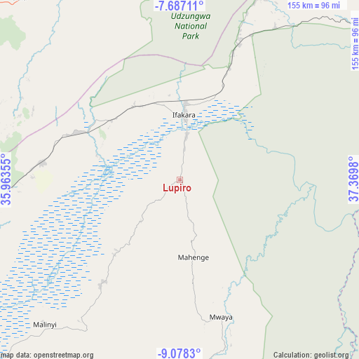
Lupiro GPS coordinates[2]
8° 22' 59.988" South, 36° 40' 0.012" East
| Map corner | latitude | longitude |
|---|---|---|
| Upper-left | -7.68711°, | 35.96355° |
| Center: | -8.38333°, | 36.66667° |
| Lower-right: | -9.0783°, | 37.3698° |
| Map W x H: | 154.7×154.7 km | = 96.1×96.1mi |
| max Lat: | -1.14389° ⇑76.2% North |
| Lupiro: | -8.38333° |
| min Lat: | ⇓23.8% South -11.36667° |
| min Long | Lupiro | max Long |
| 29.62667° | 36.66667° | 40.33333° |
| W 61.2%⇐ | ⇒38.8% E |
Elevation
Elevation of Lupiro is 299 m = 981 ft, and this is 643.8 m = 2112 ft below average elevation for this country.
| Max E: |
2377 m = 7799 ft | 79.7% |
| Avg. | 942.8 m = 3093 ft | |
| Lupiro | 299 m = 981 ft | |
Min E: |
0 m = 0 ft | 20.3% |
See also: Tanzania elevation on elevation.city.
Geographical zone
Lupiro is located in South Torrid zone (between Equator and Tropic of Capricorn). Distance of Equator is 932.1 km =579.2 mi to North.| Distance of | km | miles | from Lupiro |
|---|---|---|---|
| Equator | 932.1 | 579.2 | to North |
| Tropic Capricorn | 1673.8 | 1040.1 | to South |
| Antarctic Circle | 6469 | 4019.6 | to South |
| South Pole | 9074.9 | 5638.9 | to South |


Nearby cities:
15 places around Lupiro: (largest is in red/bold)
• Ifakara
27.9 km =17.3 mi,  3°
3°
• Ilula
104.8 km =65.1 mi,  318°
318°
• Iringa
126.6 km =78.7 mi,  302°
302°
• Izazi
167 km =103.8 mi, 321°
• Kidatu
82.5 km =51.3 mi,  22°
22°
• Kidodi
94.3 km =58.6 mi, 23°
• Kilosa
175.8 km =109.2 mi,  11°
11°
• Kimamba
185.2 km =115.1 mi, 16°
• Kisanga
155.3 km =96.5 mi,  47°
47°
• Mahenge
33.8 km =21 mi,  170°
170°
• Makungu
157 km =97.6 mi,  255°
255°
• Malinyi
84.7 km =52.6 mi,  223°
223°
• Mikumi
114.3 km =71 mi, 17°
• Mlimba
104.3 km =64.8 mi,  243°
243°
• Mtimbira
56.5 km =35.1 mi, 218°
Sources, notices
• [Note1] Compared only with cities in Tanzania existing in our database
• [Src1] Map data: © OpenStreetMap contributors (CC-BY-SA)
• [Src2] Other city data from geonames.org with taken over terms of usage.
• [Src3] Geographical zone / Annual Mean Temperature by Robert A. Rohde @ Wikipedia
