Malinyi geodata
Malinyi (Morogoro) is a populated place; located in Tanzania in Africa/Dar_es_Salaam (GMT+3) time zone. With population of 27,041 people, there are 75 cities with bigger population in this country. Compared to other cities in Tanzania, 81.1% of cities are located further ↑North; 58.7% of cities are located further ←West and 80.1% of cities have higher elevation than Malinyi. Note1


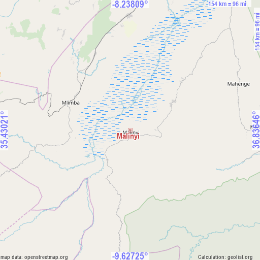
Malinyi GPS coordinates[2]
8° 55' 59.988" South, 36° 7' 59.988" East
| Map corner | latitude | longitude |
|---|---|---|
| Upper-left | -8.23809°, | 35.43021° |
| Center: | -8.93333°, | 36.13333° |
| Lower-right: | -9.62725°, | 36.83646° |
| Map W x H: | 154.5×154.5 km | = 96×96mi |
| max Lat: | -1.14389° ⇑81.1% North |
| Malinyi: | -8.93333° |
| min Lat: | ⇓18.9% South -11.36667° |
| min Long | Malinyi | max Long |
| 29.62667° | 36.13333° | 40.33333° |
| W 58.7%⇐ | ⇒41.3% E |
Elevation
Elevation of Malinyi is 295 m = 968 ft, and this is 647.8 m = 2125 ft below average elevation for this country.
| Max E: |
2377 m = 7799 ft | 80.1% |
| Avg. | 942.8 m = 3093 ft | |
| Malinyi | 295 m = 968 ft | |
Min E: |
0 m = 0 ft | 19.9% |
See also: Tanzania elevation on elevation.city.
Geographical zone
Malinyi is located in South Torrid zone (between Equator and Tropic of Capricorn). Distance of Equator is 993.3 km =617.2 mi to North.| Distance of | km | miles | from Malinyi |
|---|---|---|---|
| Equator | 993.3 | 617.2 | to North |
| Tropic Capricorn | 1612.6 | 1002 | to South |
| Antarctic Circle | 6407.9 | 3981.7 | to South |
| South Pole | 9013.8 | 5600.9 | to South |


Nearby cities:
15 places around Malinyi: (largest is in red/bold)
• Ifakara
107.6 km =66.9 mi,  34°
34°
• Ilembula
170.3 km =105.8 mi,  271°
271°
• Ilula
140.1 km =87.1 mi,  355°
355°
• Iringa
138.2 km =85.9 mi,  339°
339°
• Kidatu
164.5 km =102.2 mi, 33°
• Lupiro
84.7 km =52.6 mi,  43°
43°
• Mahanje
141.6 km =88 mi,  218°
218°
• Mahenge
69.9 km =43.4 mi,  66°
66°
• Makumbako
143.1 km =88.9 mi, 273°
• Makungu
96 km =59.7 mi,  283°
283°
• Malangali
146.8 km =91.2 mi,  286°
286°
• Mlimba
37.8 km =23.5 mi, 293°
• Mtimbira
29.1 km =18.1 mi,  54°
54°
• Mtwango
146.7 km =91.2 mi, 266°
• Njombe
156.5 km =97.2 mi,  252°
252°
Sources, notices
• [Note1] Compared only with cities in Tanzania existing in our database
• [Src1] Map data: © OpenStreetMap contributors (CC-BY-SA)
• [Src2] Other city data from geonames.org with taken over terms of usage.
• [Src3] Geographical zone / Annual Mean Temperature by Robert A. Rohde @ Wikipedia
