Kondoa geodata
Kondoa (Dodoma) is a populated place; located in Tanzania in Africa/Dar_es_Salaam (GMT+3) time zone. With population of 23,518 people, there are 100 cities with bigger population in this country. Compared to other cities in Tanzania, 57% of cities are located further ↓South; 56.3% of cities are located further ←West and 77.3% of cities have lower elevation than Kondoa. Note1


Kondoa GPS coordinates[2]
4° 54' 0" South, 35° 46' 59.988" East
| Map corner | latitude | longitude |
|---|---|---|
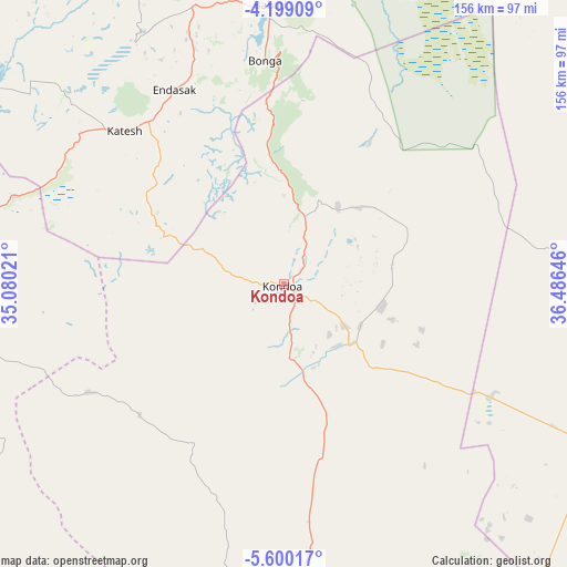
| Upper-left | -4.19909°, | 35.08021° |
| Center: | -4.9°, | 35.78333° |
| Lower-right: | -5.60017°, | 36.48646° |
| Map W x H: | 155.8×155.8 km | = 96.8×96.8mi |
| max Lat: | -1.14389° ⇑43% North |
| Kondoa: | -4.9° |
| min Lat: | ⇓57% South -11.36667° |
| min Long | Kondoa | max Long |
| 29.62667° | 35.78333° | 40.33333° |
| W 56.3%⇐ | ⇒43.7% E |
Elevation
Elevation of Kondoa is 1378 m = 4521 ft, and this is 435.2 m = 1428 ft above average elevation for this country.
| Max E: |
2377 m = 7799 ft | 22.7% |
| Kondoa | 1378 m 4521 ft | |
| Avg. | 942.8 m = 3093 ft | |
Min E: |
0 m = 0 ft | 77.3% |
See also: Tanzania elevation on elevation.city.
Geographical zone
Kondoa is located in South Torrid zone (between Equator and Tropic of Capricorn). Distance of Equator is 544.8 km =338.5 mi to North.| Distance of | km | miles | from Kondoa |
|---|---|---|---|
| Equator | 544.8 | 338.5 | to North |
| Tropic Capricorn | 2061.1 | 1280.7 | to South |
| Antarctic Circle | 6856.3 | 4260.3 | to South |
| South Pole | 9462.2 | 5879.5 | to South |


Nearby cities:
15 places around Kondoa: (largest is in red/bold)
• Babati
76.1 km =47.3 mi,  357°
357°
• Bashanet
84.5 km =52.5 mi,  331°
331°
• Basotu
97.6 km =60.6 mi,  307°
307°
• Dareda
80.3 km =49.9 mi,  341°
341°
• Dongobesh
102.7 km =63.8 mi, 334°
• Endasak
61.3 km =38.1 mi, 331°
• Galappo
70.8 km =44 mi,  5°
5°
• Ikungi
115.6 km =71.8 mi,  257°
257°
• Ilongero
104.8 km =65.1 mi,  284°
284°
• Katesh
60.7 km =37.7 mi, 313°
• Kibaya
97.5 km =60.6 mi,  117°
117°
• Magugu
98.2 km =61 mi, 358°
• Mtinko
110.5 km =68.7 mi,  290°
290°
• Mungaa
100 km =62.1 mi,  265°
265°
• Nangwa
60.7 km =37.7 mi,  322°
322°
Sources, notices
• [Note1] Compared only with cities in Tanzania existing in our database
• [Src1] Map data: © OpenStreetMap contributors (CC-BY-SA)
• [Src2] Other city data from geonames.org with taken over terms of usage.
• [Src3] Geographical zone / Annual Mean Temperature by Robert A. Rohde @ Wikipedia
