Orikhiv geodata
Orikhiv (Zaporizhia) is a seat of a second-order administrative division; located in Ukraine in Europe/Zaporozhye (GMT+3) time zone. With population of 17,287 people, there are 225 cities with bigger population in this country. Compared to other cities in Ukraine, 60.3% of cities are located further ↑North; 85.8% of cities are located further ←West and 76.1% of cities have higher elevation than Orikhiv. Note1


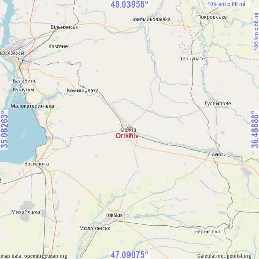
Orikhiv GPS coordinates[2]
47° 34' 2.316" North, 35° 47' 8.7" East
| Map corner | latitude | longitude |
|---|---|---|
| Upper-left | 48.03958°, | 35.08263° |
| Center: | 47.56731°, | 35.78575° |
| Lower-right: | 47.09075°, | 36.48888° |
| Map W x H: | 105.5×105.5 km | = 65.6×65.6mi |
| max Lat: | 52.18903° ⇑60.3% North |
| Orikhiv: | 47.56731° |
| min Lat: | ⇓39.7% South 44.39214° |
| min Long | Orikhiv | max Long |
| 22.20555° | 35.78575° | 40.13222° |
| W 85.8%⇐ | ⇒14.2% E |
Elevation
Elevation of Orikhiv is 57 m = 187 ft, and this is 98.8 m = 324 ft below average elevation for this country.
| Max E: |
886 m = 2907 ft | 76.1% |
| Avg. | 155.8 m = 511 ft | |
| Orikhiv | 57 m = 187 ft | |
Min E: |
-3 m = -10 ft | 23.9% |
See also: Ukraine elevation on elevation.city.
Geographical zone
Orikhiv is located in North temperate zone (between Tropic of Cancer and the Arctic Circle). Distance of this North polar circle is 2112.2 km =1312.5 mi to North.| Distance of | km | miles | from Orikhiv |
|---|---|---|---|
| North Pole | 4718.1 | 2931.7 | to North |
| Arctic Circle | 2112.2 | 1312.5 | to North |
| Tropic Cancer | 2683.1 | 1667.2 | to South |
| Equator | 5289 | 3286.4 | to South |


Nearby cities:
15 places around Orikhiv: (largest is in red/bold)
• Chapayevka
43.3 km =26.9 mi,  104°
104°
• Hulyaypole
36.9 km =22.9 mi,  73°
73°
• Kirove
11.7 km =7.3 mi,  324°
324°
• Komyshuvakha
25.3 km =15.7 mi,  310°
310°
• Kushuhum
46.1 km =28.6 mi,  290°
290°
• Mala Tokmachka
8.8 km =5.5 mi,  113°
113°
• Malokaterynivka
40.9 km =25.4 mi,  283°
283°
• Novomykolayivka
46.6 km =29 mi,  11°
11°
• Polohy
36.3 km =22.6 mi, 104°
• Preobrazhenka
2.4 km =1.5 mi,  77°
77°
• Pryshyb
49 km =30.4 mi,  225°
225°
• Ternuvate
38.9 km =24.2 mi,  41°
41°
• Tokmak
35.1 km =21.8 mi,  189°
189°
• Vasylivka
41.1 km =25.5 mi,  249°
249°
• Zaliznychne
30 km =18.6 mi, 71°
Sources, notices
• [Note1] Compared only with cities in Ukraine existing in our database
• [Src1] Map data: © OpenStreetMap contributors (CC-BY-SA)
• [Src2] Other city data from geonames.org with taken over terms of usage.
• [Src3] Geographical zone / Annual Mean Temperature by Robert A. Rohde @ Wikipedia
