Zolotonosha geodata
Zolotonosha (Cherkasy) is a seat of a second-order administrative division; located in Ukraine in Europe/Kiev (GMT+3) time zone. With population of 27,722 people, there are 153 cities with bigger population in this country. Compared to other cities in Ukraine, 77.5% of cities are located further ↓South; 57.1% of cities are located further →East and 64.3% of cities have higher elevation than Zolotonosha. Note1


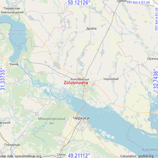
Zolotonosha GPS coordinates[2]
49° 40' 5.952" North, 32° 2' 25.692" East
| Map corner | latitude | longitude |
|---|---|---|
| Upper-left | 50.12126°, | 31.33735° |
| Center: | 49.66832°, | 32.04047° |
| Lower-right: | 49.21112°, | 32.7436° |
| Map W x H: | 101.2×101.2 km | = 62.9×62.9mi |
| max Lat: | 52.18903° ⇑22.5% North |
| Zolotonosha: | 49.66832° |
| min Lat: | ⇓77.5% South 44.39214° |
| min Long | Zolotonosha | max Long |
| 22.20555° | 32.04047° | 40.13222° |
| W 42.9%⇐ | ⇒57.1% E |
Elevation
Elevation of Zolotonosha is 93 m = 305 ft, and this is 62.8 m = 206 ft below average elevation for this country.
| Max E: |
886 m = 2907 ft | 64.3% |
| Avg. | 155.8 m = 511 ft | |
| Zolotonosha | 93 m = 305 ft | |
Min E: |
-3 m = -10 ft | 35.7% |
See also: Ukraine elevation on elevation.city.
Geographical zone
Zolotonosha is located in North temperate zone (between Tropic of Cancer and the Arctic Circle). Distance of this North polar circle is 1878.6 km =1167.3 mi to North.| Distance of | km | miles | from Zolotonosha |
|---|---|---|---|
| North Pole | 4484.5 | 2786.5 | to North |
| Arctic Circle | 1878.6 | 1167.3 | to North |
| Tropic Cancer | 2916.7 | 1812.4 | to South |
| Equator | 5522.6 | 3431.6 | to South |


Nearby cities:
15 places around Zolotonosha: (largest is in red/bold)
• Bogdanivka
61.2 km =38 mi,  358°
358°
• Cherkasy
26.7 km =16.6 mi,  176°
176°
• Chervona Sloboda
33.9 km =21.1 mi,  165°
165°
• Chornobay
20.8 km =12.9 mi,  90°
90°
• Drabiv
33.3 km =20.7 mi,  12°
12°
• Horodyshche
60.6 km =37.7 mi,  225°
225°
• Hrebinka
57.4 km =35.7 mi,  29°
29°
• Kaniv
42.8 km =26.6 mi,  282°
282°
• Mliiv
52.8 km =32.8 mi, 225°
• Moshny
26.9 km =16.7 mi, 234°
• Orzhytsya
49.3 km =30.6 mi,  74°
74°
• Pereiaslav-Khmelnytskyi
61.3 km =38.1 mi,  316°
316°
• Ruska Poliana
29.3 km =18.2 mi,  197°
197°
• Smila
50.8 km =31.6 mi,  192°
192°
• Tsybli
49.9 km =31 mi, 316°
Sources, notices
• [Note1] Compared only with cities in Ukraine existing in our database
• [Src1] Map data: © OpenStreetMap contributors (CC-BY-SA)
• [Src2] Other city data from geonames.org with taken over terms of usage.
• [Src3] Geographical zone / Annual Mean Temperature by Robert A. Rohde @ Wikipedia
