Hrebinka geodata
Hrebinka (Poltava) is a seat of a second-order administrative division; located in Ukraine in Europe/Kiev (GMT+3) time zone. With population of 11,017 people, there are 329 cities with bigger population in this country. Compared to other cities in Ukraine, 85.5% of cities are located further ↓South; 55.7% of cities are located further →East and 57.7% of cities have higher elevation than Hrebinka. Note1


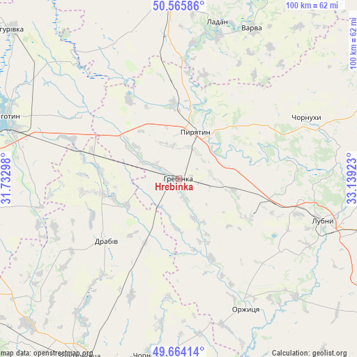
Hrebinka GPS coordinates[2]
50° 7' 1.632" North, 32° 26' 9.96" East
| Map corner | latitude | longitude |
|---|---|---|
| Upper-left | 50.56586°, | 31.73298° |
| Center: | 50.11712°, | 32.4361° |
| Lower-right: | 49.66414°, | 33.13923° |
| Map W x H: | 100.3×100.3 km | = 62.3×62.3mi |
| max Lat: | 52.18903° ⇑14.5% North |
| Hrebinka: | 50.11712° |
| min Lat: | ⇓85.5% South 44.39214° |
| min Long | Hrebinka | max Long |
| 22.20555° | 32.4361° | 40.13222° |
| W 44.3%⇐ | ⇒55.7% E |
Elevation
Elevation of Hrebinka is 113 m = 371 ft, and this is 42.8 m = 140 ft below average elevation for this country.
| Max E: |
886 m = 2907 ft | 57.7% |
| Avg. | 155.8 m = 511 ft | |
| Hrebinka | 113 m = 371 ft | |
Min E: |
-3 m = -10 ft | 42.3% |
See also: Ukraine elevation on elevation.city.
Geographical zone
Hrebinka is located in North temperate zone (between Tropic of Cancer and the Arctic Circle). Distance of this North polar circle is 1828.7 km =1136.3 mi to North.| Distance of | km | miles | from Hrebinka |
|---|---|---|---|
| North Pole | 4434.6 | 2755.5 | to North |
| Arctic Circle | 1828.7 | 1136.3 | to North |
| Tropic Cancer | 2966.6 | 1843.4 | to South |
| Equator | 5572.5 | 3462.6 | to South |


Nearby cities:
15 places around Hrebinka: (largest is in red/bold)
• Bogdanivka
32 km =19.9 mi,  290°
290°
• Chernyakhivka
37.7 km =23.4 mi, 287°
• Chervone
43.8 km =27.2 mi,  307°
307°
• Chornobay
50.7 km =31.5 mi,  188°
188°
• Chornukhy
39.7 km =24.7 mi,  65°
65°
• Drabiv
27.4 km =17 mi,  230°
230°
• Ladan
45.9 km =28.5 mi,  13°
13°
• Lozovyy Yar
38.7 km =24 mi, 306°
• Lubny
41.6 km =25.8 mi,  105°
105°
• Orzhytsya
41 km =25.5 mi,  152°
152°
• Pryluky
53.1 km =33 mi,  356°
356°
• Pyryatyn
14.8 km =9.2 mi,  19°
19°
• Varva
46.6 km =29 mi,  25°
25°
• Yahotyn
51.2 km =31.8 mi, 290°
• Zhuravka
42 km =26.1 mi, 15°
Sources, notices
• [Note1] Compared only with cities in Ukraine existing in our database
• [Src1] Map data: © OpenStreetMap contributors (CC-BY-SA)
• [Src2] Other city data from geonames.org with taken over terms of usage.
• [Src3] Geographical zone / Annual Mean Temperature by Robert A. Rohde @ Wikipedia
