Velyka Pysarivka geodata
Velyka Pysarivka (Sumy) is a seat of a second-order administrative division; located in Ukraine in Europe/Kiev (GMT+3) time zone. With population of 5,235 people, there are 628 cities with bigger population in this country. Compared to other cities in Ukraine, 90% of cities are located further ↓South; 84.5% of cities are located further ←West and 55.4% of cities have higher elevation than Velyka Pysarivka. Note1


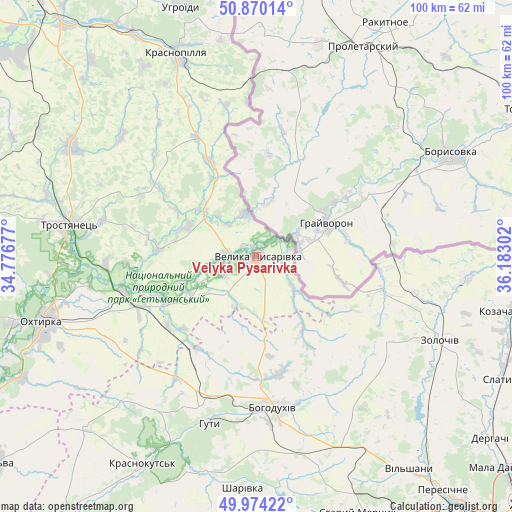
Velyka Pysarivka GPS coordinates[2]
50° 25' 27.48" North, 35° 28' 47.604" East
| Map corner | latitude | longitude |
|---|---|---|
| Upper-left | 50.87014°, | 34.77677° |
| Center: | 50.4243°, | 35.47989° |
| Lower-right: | 49.97422°, | 36.18302° |
| Map W x H: | 99.6×99.6 km | = 61.9×61.9mi |
| max Lat: | 52.18903° ⇑10% North |
| Velyka Pysarivka: | 50.4243° |
| min Lat: | ⇓90% South 44.39214° |
| min Long | Velyka Pysarivk | max Long |
| 22.20555° | 35.47989° | 40.13222° |
| W 84.5%⇐ | ⇒15.5% E |
Elevation
Elevation of Velyka Pysarivka is 119 m = 390 ft, and this is 36.8 m = 121 ft below average elevation for this country.
| Max E: |
886 m = 2907 ft | 55.4% |
| Avg. | 155.8 m = 511 ft | |
| Velyka Pysarivka | 119 m = 390 ft | |
Min E: |
-3 m = -10 ft | 44.6% |
See also: Ukraine elevation on elevation.city.
Geographical zone
Velyka Pysarivka is located in North temperate zone (between Tropic of Cancer and the Arctic Circle). Distance of this North polar circle is 1794.5 km =1115.1 mi to North.| Distance of | km | miles | from Velyka Pysarivka |
|---|---|---|---|
| North Pole | 4400.4 | 2734.3 | to North |
| Arctic Circle | 1794.5 | 1115.1 | to North |
| Tropic Cancer | 3000.7 | 1864.5 | to South |
| Equator | 5606.7 | 3483.8 | to South |


Nearby cities:
15 places around Velyka Pysarivka: (largest is in red/bold)
• Bohodukhiv
29.1 km =18.1 mi,  173°
173°
• Boromlya
42 km =26.1 mi,  300°
300°
• Huty
33.8 km =21 mi,  196°
196°
• Krasnokuts’k
45.8 km =28.5 mi,  209°
209°
• Krasnopillya
41.9 km =26 mi,  338°
338°
• Kyrykivka
26.7 km =16.6 mi,  255°
255°
• Manchenky
56.3 km =35 mi,  151°
151°
• Mezenivka
26.2 km =16.3 mi,  333°
333°
• Okhtyrka
43.1 km =26.8 mi,  252°
252°
• Peresichna
56.9 km =35.4 mi,  141°
141°
• Prudyanka
53.2 km =33.1 mi,  113°
113°
• Slatyne
53.4 km =33.2 mi,  116°
116°
• Staryy Merchyk
53.1 km =33 mi,  158°
158°
• Trostyanets’
37 km =23 mi,  280°
280°
• Zolochiv
39.1 km =24.3 mi, 114°
Sources, notices
• [Note1] Compared only with cities in Ukraine existing in our database
• [Src1] Map data: © OpenStreetMap contributors (CC-BY-SA)
• [Src2] Other city data from geonames.org with taken over terms of usage.
• [Src3] Geographical zone / Annual Mean Temperature by Robert A. Rohde @ Wikipedia
