Bashtanka geodata
Bashtanka (Mykolaiv) is a seat of a second-order administrative division; located in Ukraine in Europe/Kiev (GMT+3) time zone. With population of 12,657 people, there are 295 cities with bigger population in this country. Compared to other cities in Ukraine, 61.4% of cities are located further ↑North; 55.6% of cities are located further →East and 69.2% of cities have higher elevation than Bashtanka. Note1


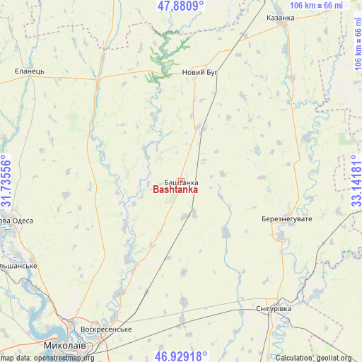
Bashtanka GPS coordinates[2]
47° 24' 25.884" North, 32° 26' 19.248" East
| Map corner | latitude | longitude |
|---|---|---|
| Upper-left | 47.8809°, | 31.73556° |
| Center: | 47.40719°, | 32.43868° |
| Lower-right: | 46.92918°, | 33.14181° |
| Map W x H: | 105.8×105.8 km | = 65.7×65.7mi |
| max Lat: | 52.18903° ⇑61.4% North |
| Bashtanka: | 47.40719° |
| min Lat: | ⇓38.6% South 44.39214° |
| min Long | Bashtanka | max Long |
| 22.20555° | 32.43868° | 40.13222° |
| W 44.4%⇐ | ⇒55.6% E |
Elevation
Elevation of Bashtanka is 77 m = 253 ft, and this is 78.8 m = 259 ft below average elevation for this country.
| Max E: |
886 m = 2907 ft | 69.2% |
| Avg. | 155.8 m = 511 ft | |
| Bashtanka | 77 m = 253 ft | |
Min E: |
-3 m = -10 ft | 30.8% |
See also: Ukraine elevation on elevation.city.
Geographical zone
Bashtanka is located in North temperate zone (between Tropic of Cancer and the Arctic Circle). Distance of this North polar circle is 2130 km =1323.5 mi to North.| Distance of | km | miles | from Bashtanka |
|---|---|---|---|
| North Pole | 4735.9 | 2942.8 | to North |
| Arctic Circle | 2130 | 1323.5 | to North |
| Tropic Cancer | 2665.3 | 1656.1 | to South |
| Equator | 5271.2 | 3275.4 | to South |


Nearby cities:
15 places around Bashtanka: (largest is in red/bold)
• Bereznehuvate
32.9 km =20.4 mi,  109°
109°
• Bobrynets
75.3 km =46.8 mi,  344°
344°
• Chornobayivka
79.8 km =49.6 mi,  173°
173°
• Kazanka
56.6 km =35.2 mi,  30°
30°
• Mykolayiv
59.3 km =36.8 mi,  214°
214°
• Nova Odesa
50.5 km =31.4 mi,  257°
257°
• Novyy Buh
32.4 km =20.1 mi,  11°
11°
• Ol'shanskoye
54.6 km =33.9 mi,  242°
242°
• Oleksandrivka
67.8 km =42.1 mi,  158°
158°
• Shevchenkove
63.1 km =39.2 mi,  196°
196°
• Shyroke
69.1 km =42.9 mi,  62°
62°
• Snihurivka
46.1 km =28.6 mi,  143°
143°
• Ustynivka
61.4 km =38.2 mi, 6°
• Velyka Oleksandrivka
65.9 km =40.9 mi,  98°
98°
• Yelanets’
54.5 km =33.9 mi,  306°
306°
In other languages:
- In France: Bachtanka
- In German: Baschtanka
- In Russian: Баштанка
- In Chinese: 巴什坦卡
Sources, notices
• [Note1] Compared only with cities in Ukraine existing in our database
• [Src1] Map data: © OpenStreetMap contributors (CC-BY-SA)
• [Src2] Other city data from geonames.org with taken over terms of usage.
• [Src3] Geographical zone / Annual Mean Temperature by Robert A. Rohde @ Wikipedia
