Zakharivka geodata
Zakharivka (Odesa) is a seat of a second-order administrative division; located in Ukraine in Europe/Kiev (GMT+3) time zone. With population of 5,007 people, there are 652 cities with bigger population in this country. Compared to other cities in Ukraine, 61.8% of cities are located further ↑North; 69% of cities are located further →East and 72.8% of cities have higher elevation than Zakharivka. Note1


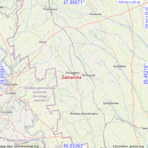
Zakharivka GPS coordinates[2]
47° 19' 56.352" North, 29° 45' 32.508" East
| Map corner | latitude | longitude |
|---|---|---|
| Upper-left | 47.80671°, | 29.05591° |
| Center: | 47.33232°, | 29.75903° |
| Lower-right: | 46.85363°, | 30.46216° |
| Map W x H: | 106×106 km | = 65.9×65.9mi |
| max Lat: | 52.18903° ⇑61.8% North |
| Zakharivka: | 47.33232° |
| min Lat: | ⇓38.2% South 44.39214° |
| min Long | Zakharivka | max Long |
| 22.20555° | 29.75903° | 40.13222° |
| W 31%⇐ | ⇒69% E |
Elevation
Elevation of Zakharivka is 68 m = 223 ft, and this is 87.8 m = 288 ft below average elevation for this country.
| Max E: |
886 m = 2907 ft | 72.8% |
| Avg. | 155.8 m = 511 ft | |
| Zakharivka | 68 m = 223 ft | |
Min E: |
-3 m = -10 ft | 27.2% |
See also: Ukraine elevation on elevation.city.
Geographical zone
Zakharivka is located in North temperate zone (between Tropic of Cancer and the Arctic Circle). Distance of this North polar circle is 2138.3 km =1328.7 mi to North.| Distance of | km | miles | from Zakharivka |
|---|---|---|---|
| North Pole | 4744.2 | 2947.9 | to North |
| Arctic Circle | 2138.3 | 1328.7 | to North |
| Tropic Cancer | 2656.9 | 1650.9 | to South |
| Equator | 5262.9 | 3270.2 | to South |


Nearby cities:
15 places around Zakharivka: (largest is in red/bold)
• Ananyiv Pershyi
45.4 km =28.2 mi,  17°
17°
• Balta
67.9 km =42.2 mi,  351°
351°
• Ivanivka
66.8 km =41.5 mi,  126°
126°
• Kuchurhan
19 km =11.8 mi,  173°
173°
• Lyubashivka
67.5 km =41.9 mi,  33°
33°
• Mayaky
19.2 km =11.9 mi,  308°
308°
• Okny
32.3 km =20.1 mi,  315°
315°
• Pavlivka
65.9 km =40.9 mi,  164°
164°
• Podil’s’k
49.8 km =30.9 mi,  339°
339°
• Rozdil’na
59.5 km =37 mi, 155°
• Shyryayeve
33.4 km =20.8 mi,  80°
80°
• Stepanivka
62.2 km =38.6 mi, 163°
• Velyka Mykhaylivka
29.1 km =18.1 mi, 165°
• Velykoploske
36.2 km =22.5 mi,  190°
190°
• Zatyshshya
8.6 km =5.3 mi,  89°
89°
Sources, notices
• [Note1] Compared only with cities in Ukraine existing in our database
• [Src1] Map data: © OpenStreetMap contributors (CC-BY-SA)
• [Src2] Other city data from geonames.org with taken over terms of usage.
• [Src3] Geographical zone / Annual Mean Temperature by Robert A. Rohde @ Wikipedia
