Ropcha geodata
Ropcha (Chernivtsi Oblast') is a populated place; located in Ukraine in Europe/Kiev (GMT+3) time zone. With population of 3,189 people, there are 889 cities with bigger population in this country. Compared to other cities in Ukraine, 54.3% of cities are located further ↑North; 81.8% of cities are located further →East and 93.8% of cities have lower elevation than Ropcha. Note1


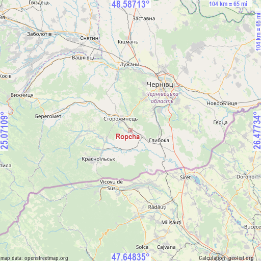
Ropcha GPS coordinates[2]
48° 7' 11.568" North, 25° 46' 27.156" East
| Map corner | latitude | longitude |
|---|---|---|
| Upper-left | 48.58713°, | 25.07109° |
| Center: | 48.11988°, | 25.77421° |
| Lower-right: | 47.64835°, | 26.47734° |
| Map W x H: | 104.4×104.4 km | = 64.9×64.9mi |
| max Lat: | 52.18903° ⇑54.3% North |
| Ropcha: | 48.11988° |
| min Lat: | ⇓45.7% South 44.39214° |
| min Long | Ropcha | max Long |
| 22.20555° | 25.77421° | 40.13222° |
| W 18.2%⇐ | ⇒81.8% E |
Elevation
Elevation of Ropcha is 344 m = 1129 ft, and this is 188.2 m = 617 ft above average elevation for this country.
| Max E: |
886 m = 2907 ft | 6.2% |
| Ropcha | 344 m 1129 ft | |
| Avg. | 155.8 m = 511 ft | |
Min E: |
-3 m = -10 ft | 93.8% |
See also: Ukraine elevation on elevation.city.
Geographical zone
Ropcha is located in North temperate zone (between Tropic of Cancer and the Arctic Circle). Distance of this North polar circle is 2050.7 km =1274.2 mi to North.| Distance of | km | miles | from Ropcha |
|---|---|---|---|
| North Pole | 4656.6 | 2893.5 | to North |
| Arctic Circle | 2050.7 | 1274.2 | to North |
| Tropic Cancer | 2744.5 | 1705.4 | to South |
| Equator | 5350.4 | 3324.6 | to South |


Nearby cities:
15 places around Ropcha: (largest is in red/bold)
• Berehomet
32.3 km =20.1 mi,  281°
281°
• Boyany
31 km =19.3 mi,  57°
57°
• Chernivtsi
22.7 km =14.1 mi,  32°
32°
• Chudey
13.6 km =8.5 mi,  236°
236°
• Davydivka
15.6 km =9.7 mi,  270°
270°
• Hlyboka
12 km =7.5 mi,  106°
106°
• Luzhany
27.2 km =16.9 mi,  359°
359°
• Molodiya
21.6 km =13.4 mi, 57°
• Myhove
29.6 km =18.4 mi, 278°
• Nyzhni Petrivtsi
10.8 km =6.7 mi,  200°
200°
• Shypyntsi
28.6 km =17.8 mi, 355°
• Storozhynets’
6.4 km =4 mi,  320°
320°
• Vashkivtsi
35.4 km =22 mi,  326°
326°
• Voloka
14.1 km =8.8 mi, 55°
• Yizhivtsi
12.2 km =7.6 mi,  222°
222°
Sources, notices
• [Note1] Compared only with cities in Ukraine existing in our database
• [Src1] Map data: © OpenStreetMap contributors (CC-BY-SA)
• [Src2] Other city data from geonames.org with taken over terms of usage.
• [Src3] Geographical zone / Annual Mean Temperature by Robert A. Rohde @ Wikipedia
