Pechenihy geodata
Pechenihy (Kharkiv) is a seat of a second-order administrative division; located in Ukraine in Europe/Kiev (GMT+3) time zone. In our database, there are 1661 cities with bigger population. Compared to other cities in Ukraine, 81.1% of cities are located further ↓South; 90.8% of cities are located further ←West and 63.5% of cities have higher elevation than Pechenihy. Note1


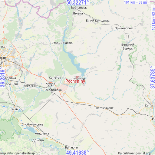
Pechenihy GPS coordinates[2]
49° 52' 18.012" North, 36° 56' 4.992" East
| Map corner | latitude | longitude |
|---|---|---|
| Upper-left | 50.32271°, | 36.2316° |
| Center: | 49.87167°, | 36.93472° |
| Lower-right: | 49.41638°, | 37.63785° |
| Map W x H: | 100.8×100.8 km | = 62.6×62.6mi |
| max Lat: | 52.18903° ⇑18.9% North |
| Pechenihy: | 49.87167° |
| min Lat: | ⇓81.1% South 44.39214° |
| min Long | Pechenihy | max Long |
| 22.20555° | 36.93472° | 40.13222° |
| W 90.8%⇐ | ⇒9.2% E |
Elevation
Elevation of Pechenihy is 95 m = 312 ft, and this is 60.8 m = 199 ft below average elevation for this country.
| Max E: |
886 m = 2907 ft | 63.5% |
| Avg. | 155.8 m = 511 ft | |
| Pechenihy | 95 m = 312 ft | |
Min E: |
-3 m = -10 ft | 36.5% |
See also: Ukraine elevation on elevation.city.
Geographical zone
Pechenihy is located in North temperate zone (between Tropic of Cancer and the Arctic Circle). Distance of this North polar circle is 1856 km =1153.3 mi to North.| Distance of | km | miles | from Pechenihy |
|---|---|---|---|
| North Pole | 4461.9 | 2772.5 | to North |
| Arctic Circle | 1856 | 1153.3 | to North |
| Tropic Cancer | 2939.3 | 1826.4 | to South |
| Equator | 5545.2 | 3445.6 | to South |


Nearby cities:
15 places around Pechenihy: (largest is in red/bold)
• Balakliya
45.8 km =28.5 mi,  186°
186°
• Chuhuyiv
18.1 km =11.2 mi,  257°
257°
• Eskhar
26.1 km =16.2 mi,  251°
251°
• Kochetok
14.2 km =8.8 mi,  273°
273°
• Kulynychi
41.4 km =25.7 mi,  287°
287°
• Lyman
45.2 km =28.1 mi,  227°
227°
• Malynivka
15.7 km =9.8 mi, 247°
• Novopokrovka
28.1 km =17.5 mi, 261°
• Prykolotne
43.7 km =27.2 mi,  42°
42°
• Shevchenkove
26 km =16.2 mi,  138°
138°
• Slobozhans’ke
42.4 km =26.3 mi,  223°
223°
• Staryy Saltiv
25 km =15.5 mi,  335°
335°
• Vasyshcheve
43.8 km =27.2 mi, 263°
• Velykyy Burluk
38.4 km =23.9 mi,  56°
56°
• Vvedenka
31.4 km =19.5 mi, 260°
Sources, notices
• [Note1] Compared only with cities in Ukraine existing in our database
• [Src1] Map data: © OpenStreetMap contributors (CC-BY-SA)
• [Src2] Other city data from geonames.org with taken over terms of usage.
• [Src3] Geographical zone / Annual Mean Temperature by Robert A. Rohde @ Wikipedia
