Shevchenkove geodata
Shevchenkove (Kharkiv) is a seat of a second-order administrative division; located in Ukraine in Europe/Kiev (GMT+3) time zone. With population of 7,090 people, there are 501 cities with bigger population in this country. Compared to other cities in Ukraine, 77.9% of cities are located further ↓South; 91.3% of cities are located further ←West and 60.8% of cities have lower elevation than Shevchenkove. Note1


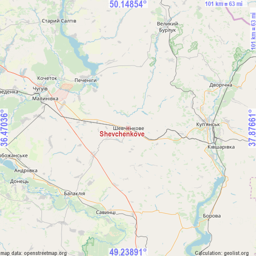
Shevchenkove GPS coordinates[2]
49° 41' 45.06" North, 37° 10' 24.528" East
| Map corner | latitude | longitude |
|---|---|---|
| Upper-left | 50.14854°, | 36.47036° |
| Center: | 49.69585°, | 37.17348° |
| Lower-right: | 49.23891°, | 37.87661° |
| Map W x H: | 101.1×101.1 km | = 62.8×62.8mi |
| max Lat: | 52.18903° ⇑22.1% North |
| Shevchenkove: | 49.69585° |
| min Lat: | ⇓77.9% South 44.39214° |
| min Long | Shevchenkove | max Long |
| 22.20555° | 37.17348° | 40.13222° |
| W 91.3%⇐ | ⇒8.7% E |
Elevation
Elevation of Shevchenkove is 171 m = 561 ft, and this is 15.2 m = 50 ft above average elevation for this country.
| Max E: |
886 m = 2907 ft | 39.2% |
| Shevchenkove | 171 m 561 ft | |
| Avg. | 155.8 m = 511 ft | |
Min E: |
-3 m = -10 ft | 60.8% |
See also: Ukraine elevation on elevation.city.
Geographical zone
Shevchenkove is located in North temperate zone (between Tropic of Cancer and the Arctic Circle). Distance of this North polar circle is 1875.5 km =1165.4 mi to North.| Distance of | km | miles | from Shevchenkove |
|---|---|---|---|
| North Pole | 4481.4 | 2784.6 | to North |
| Arctic Circle | 1875.5 | 1165.4 | to North |
| Tropic Cancer | 2919.7 | 1814.2 | to South |
| Equator | 5525.7 | 3433.5 | to South |


Nearby cities:
15 places around Shevchenkove: (largest is in red/bold)
• Balakliya
34.4 km =21.4 mi,  221°
221°
• Borova
47.9 km =29.8 mi,  137°
137°
• Chuhuyiv
38.2 km =23.7 mi,  294°
294°
• Dvorichna
40.4 km =25.1 mi,  64°
64°
• Eskhar
43.3 km =26.9 mi,  284°
284°
• Kivsharivka
37.7 km =23.4 mi,  101°
101°
• Kochetok
37.4 km =23.2 mi,  303°
303°
• Kupjansk
31.8 km =19.8 mi,  87°
87°
• Malynivka
34.4 km =21.4 mi, 293°
• Novopokrovka
47.5 km =29.5 mi, 288°
• Pechenihy
26 km =16.2 mi,  318°
318°
• Savyntsi
33.6 km =20.9 mi,  193°
193°
• Slobozhans’ke
47.9 km =29.8 mi,  256°
256°
• Velykyy Burluk
43.4 km =27 mi,  20°
20°
• Vvedenka
50.2 km =31.2 mi, 286°
Sources, notices
• [Note1] Compared only with cities in Ukraine existing in our database
• [Src1] Map data: © OpenStreetMap contributors (CC-BY-SA)
• [Src2] Other city data from geonames.org with taken over terms of usage.
• [Src3] Geographical zone / Annual Mean Temperature by Robert A. Rohde @ Wikipedia
