Ovruch geodata
Ovruch (Zhytomyr) is a seat of a second-order administrative division; located in Ukraine in Europe/Kiev (GMT+3) time zone. With population of 16,398 people, there are 237 cities with bigger population in this country. Compared to other cities in Ukraine, 97.3% of cities are located further ↓South; 73.5% of cities are located further →East and 59% of cities have lower elevation than Ovruch. Note1


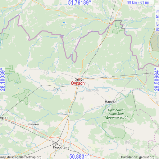
Ovruch GPS coordinates[2]
51° 19' 28.56" North, 28° 48' 12.636" East
| Map corner | latitude | longitude |
|---|---|---|
| Upper-left | 51.76189°, | 28.10039° |
| Center: | 51.3246°, | 28.80351° |
| Lower-right: | 50.8831°, | 29.50664° |
| Map W x H: | 97.7×97.7 km | = 60.7×60.7mi |
| max Lat: | 52.18903° ⇑2.7% North |
| Ovruch: | 51.3246° |
| min Lat: | ⇓97.3% South 44.39214° |
| min Long | Ovruch | max Long |
| 22.20555° | 28.80351° | 40.13222° |
| W 26.5%⇐ | ⇒73.5% E |
Elevation
Elevation of Ovruch is 165 m = 541 ft, and this is 9.2 m = 30 ft above average elevation for this country.
| Max E: |
886 m = 2907 ft | 41% |
| Ovruch | 165 m 541 ft | |
| Avg. | 155.8 m = 511 ft | |
Min E: |
-3 m = -10 ft | 59% |
See also: Ukraine elevation on elevation.city.
Geographical zone
Ovruch is located in North temperate zone (between Tropic of Cancer and the Arctic Circle). Distance of this North polar circle is 1694.4 km =1052.9 mi to North.| Distance of | km | miles | from Ovruch |
|---|---|---|---|
| North Pole | 4300.3 | 2672.1 | to North |
| Arctic Circle | 1694.4 | 1052.9 | to North |
| Tropic Cancer | 3100.8 | 1926.7 | to South |
| Equator | 5706.8 | 3546 | to South |


Nearby cities:
15 places around Ovruch: (largest is in red/bold)
• Buchmany
60.2 km =37.4 mi,  241°
241°
• Chopovychi
55.6 km =34.5 mi,  169°
169°
• Druzhba
59.7 km =37.1 mi,  255°
255°
• Ivankiv
87.4 km =54.3 mi,  119°
119°
• Khoroshiv
84.7 km =52.6 mi,  197°
197°
• Korosten’
42.2 km =26.2 mi, 195°
• Krasyatychi
65.1 km =40.5 mi, 115°
• Luhyny
38.9 km =24.2 mi,  226°
226°
• Malyn
68.5 km =42.6 mi,  153°
153°
• Narodychi
23.7 km =14.7 mi, 124°
• Nova Borova
71.2 km =44.2 mi,  189°
189°
• Novi Bilokorovychi
57.1 km =35.5 mi,  245°
245°
• Olevs’k
80.8 km =50.2 mi, 262°
• Pershotravneve
8.8 km =5.5 mi,  30°
30°
• Yemil’chyne
85.8 km =53.3 mi, 234°
Sources, notices
• [Note1] Compared only with cities in Ukraine existing in our database
• [Src1] Map data: © OpenStreetMap contributors (CC-BY-SA)
• [Src2] Other city data from geonames.org with taken over terms of usage.
• [Src3] Geographical zone / Annual Mean Temperature by Robert A. Rohde @ Wikipedia
