Druzhba geodata
Druzhba (Zhytomyr) is a populated place; located in Ukraine in Europe/Kiev (GMT+3) time zone. With population of 531 people, there are 1633 cities with bigger population in this country. Compared to other cities in Ukraine, 96.5% of cities are located further ↓South; 76% of cities are located further →East and 71.8% of cities have lower elevation than Druzhba. Note1


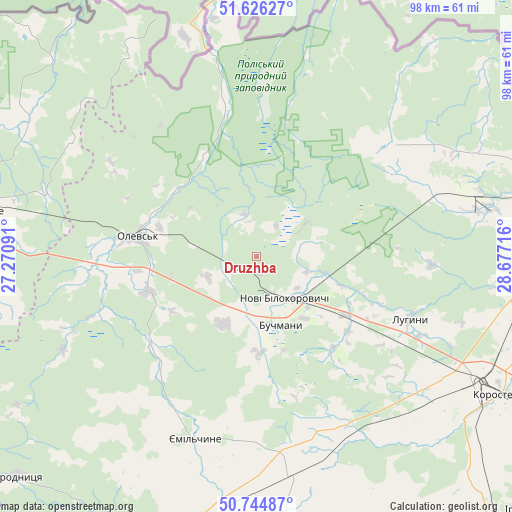
Druzhba GPS coordinates[2]
51° 11' 15.648" North, 27° 58' 26.508" East
| Map corner | latitude | longitude |
|---|---|---|
| Upper-left | 51.62627°, | 27.27091° |
| Center: | 51.18768°, | 27.97403° |
| Lower-right: | 50.74487°, | 28.67716° |
| Map W x H: | 98×98 km | = 60.9×60.9mi |
| max Lat: | 52.18903° ⇑3.5% North |
| Druzhba: | 51.18768° |
| min Lat: | ⇓96.5% South 44.39214° |
| min Long | Druzhba | max Long |
| 22.20555° | 27.97403° | 40.13222° |
| W 24%⇐ | ⇒76% E |
Elevation
Elevation of Druzhba is 213 m = 699 ft, and this is 57.2 m = 188 ft above average elevation for this country.
| Max E: |
886 m = 2907 ft | 28.2% |
| Druzhba | 213 m 699 ft | |
| Avg. | 155.8 m = 511 ft | |
Min E: |
-3 m = -10 ft | 71.8% |
See also: Ukraine elevation on elevation.city.
Geographical zone
Druzhba is located in North temperate zone (between Tropic of Cancer and the Arctic Circle). Distance of this North polar circle is 1709.6 km =1062.3 mi to North.| Distance of | km | miles | from Druzhba |
|---|---|---|---|
| North Pole | 4315.5 | 2681.5 | to North |
| Arctic Circle | 1709.6 | 1062.3 | to North |
| Tropic Cancer | 3085.6 | 1917.3 | to South |
| Equator | 5691.5 | 3536.5 | to South |


Nearby cities:
15 places around Druzhba: (largest is in red/bold)
• Buchmany
14 km =8.7 mi,  160°
160°
• Horodnytsya
62.5 km =38.8 mi,  227°
227°
• Hubkiv
76.3 km =47.4 mi,  238°
238°
• Khoroshiv
73.4 km =45.6 mi,  153°
153°
• Korosten’
52.9 km =32.9 mi,  118°
118°
• Luhyny
32 km =19.9 mi,  111°
111°
• Narodychi
77.2 km =48 mi,  88°
88°
• Nova Borova
71.9 km =44.7 mi,  139°
139°
• Novi Bilokorovychi
9.8 km =6.1 mi, 144°
• Novohrad-Volynskyi
70.6 km =43.9 mi,  200°
200°
• Olevs’k
22.8 km =14.2 mi,  280°
280°
• Ovruch
59.7 km =37.1 mi,  75°
75°
• Pershotravneve
66.2 km =41.1 mi,  69°
69°
• Rokytne
53.9 km =33.5 mi, 280°
• Yemil’chyne
36.9 km =22.9 mi, 198°
Sources, notices
• [Note1] Compared only with cities in Ukraine existing in our database
• [Src1] Map data: © OpenStreetMap contributors (CC-BY-SA)
• [Src2] Other city data from geonames.org with taken over terms of usage.
• [Src3] Geographical zone / Annual Mean Temperature by Robert A. Rohde @ Wikipedia
