Vil’shanka geodata
Vil’shanka (Kirovohrad) is a seat of a second-order administrative division; located in Ukraine in Europe/Kiev (GMT+3) time zone. In our database, there are 1661 cities with bigger population. Compared to other cities in Ukraine, 51.4% of cities are located further ↑North; 62.2% of cities are located further →East and 60.6% of cities have higher elevation than Vil’shanka. Note1


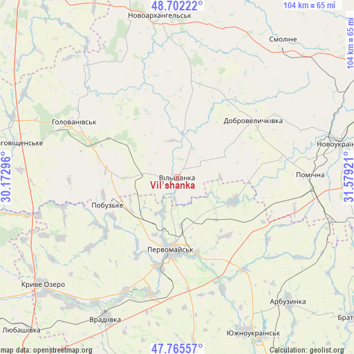
Vil’shanka GPS coordinates[2]
48° 14' 9.744" North, 30° 52' 33.888" East
| Map corner | latitude | longitude |
|---|---|---|
| Upper-left | 48.70222°, | 30.17296° |
| Center: | 48.23604°, | 30.87608° |
| Lower-right: | 47.76557°, | 31.57921° |
| Map W x H: | 104.1×104.1 km | = 64.7×64.7mi |
| max Lat: | 52.18903° ⇑51.4% North |
| Vil’shanka: | 48.23604° |
| min Lat: | ⇓48.6% South 44.39214° |
| min Long | Vil’shanka | max Long |
| 22.20555° | 30.87608° | 40.13222° |
| W 37.8%⇐ | ⇒62.2% E |
Elevation
Elevation of Vil’shanka is 104 m = 341 ft, and this is 51.8 m = 170 ft below average elevation for this country.
| Max E: |
886 m = 2907 ft | 60.6% |
| Avg. | 155.8 m = 511 ft | |
| Vil’shanka | 104 m = 341 ft | |
Min E: |
-3 m = -10 ft | 39.4% |
See also: Ukraine elevation on elevation.city.
Geographical zone
Vil’shanka is located in North temperate zone (between Tropic of Cancer and the Arctic Circle). Distance of this North polar circle is 2037.8 km =1266.2 mi to North.| Distance of | km | miles | from Vil’shanka |
|---|---|---|---|
| North Pole | 4643.7 | 2885.5 | to North |
| Arctic Circle | 2037.8 | 1266.2 | to North |
| Tropic Cancer | 2757.4 | 1713.4 | to South |
| Equator | 5363.3 | 3332.6 | to South |


Nearby cities:
15 places around Vil’shanka: (largest is in red/bold)
• Arbuzynka
49 km =30.4 mi,  137°
137°
• Blahovishchens’ke
49.2 km =30.6 mi,  282°
282°
• Dobrovelychkivka
28.1 km =17.5 mi,  53°
53°
• Holovanivs’k
34.8 km =21.6 mi,  298°
298°
• Lypnyazhka
27.7 km =17.2 mi,  32°
32°
• Lysa Hora
18.8 km =11.7 mi,  112°
112°
• Myhiya
22.8 km =14.2 mi,  165°
165°
• Novoarkhanhel’s’k
47.1 km =29.3 mi,  354°
354°
• Perehonivka
42.5 km =26.4 mi,  321°
321°
• Pervomays’k
21.4 km =13.3 mi,  185°
185°
• Pidhorodna
14.4 km =8.9 mi,  176°
176°
• Pobugskoye
22.4 km =13.9 mi,  249°
249°
• Pomichna
40 km =24.9 mi,  89°
89°
• Tyshkivka
29.4 km =18.3 mi,  9°
9°
• Vradiyivka
46.6 km =29 mi,  206°
206°
Sources, notices
• [Note1] Compared only with cities in Ukraine existing in our database
• [Src1] Map data: © OpenStreetMap contributors (CC-BY-SA)
• [Src2] Other city data from geonames.org with taken over terms of usage.
• [Src3] Geographical zone / Annual Mean Temperature by Robert A. Rohde @ Wikipedia
