Tyshkivka geodata
Tyshkivka (Kirovohrad) is a populated place; located in Ukraine in Europe/Kiev (GMT+3) time zone. With population of 3,368 people, there are 853 cities with bigger population in this country. Compared to other cities in Ukraine, 55.2% of cities are located further ↓South; 61.6% of cities are located further →East and 61.6% of cities have lower elevation than Tyshkivka. Note1


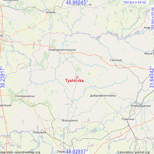
Tyshkivka GPS coordinates[2]
48° 29' 47.94" North, 30° 56' 32.244" East
| Map corner | latitude | longitude |
|---|---|---|
| Upper-left | 48.96045°, | 30.23917° |
| Center: | 48.49665°, | 30.94229° |
| Lower-right: | 48.02857°, | 31.64542° |
| Map W x H: | 103.6×103.6 km | = 64.4×64.4mi |
| max Lat: | 52.18903° ⇑44.8% North |
| Tyshkivka: | 48.49665° |
| min Lat: | ⇓55.2% South 44.39214° |
| min Long | Tyshkivka | max Long |
| 22.20555° | 30.94229° | 40.13222° |
| W 38.4%⇐ | ⇒61.6% E |
Elevation
Elevation of Tyshkivka is 174 m = 571 ft, and this is 18.2 m = 60 ft above average elevation for this country.
| Max E: |
886 m = 2907 ft | 38.4% |
| Tyshkivka | 174 m 571 ft | |
| Avg. | 155.8 m = 511 ft | |
Min E: |
-3 m = -10 ft | 61.6% |
See also: Ukraine elevation on elevation.city.
Geographical zone
Tyshkivka is located in North temperate zone (between Tropic of Cancer and the Arctic Circle). Distance of this North polar circle is 2008.9 km =1248.3 mi to North.| Distance of | km | miles | from Tyshkivka |
|---|---|---|---|
| North Pole | 4614.7 | 2867.4 | to North |
| Arctic Circle | 2008.9 | 1248.3 | to North |
| Tropic Cancer | 2786.4 | 1731.4 | to South |
| Equator | 5392.3 | 3350.6 | to South |


Nearby cities:
15 places around Tyshkivka: (largest is in red/bold)
• Babanka
43.4 km =27 mi,  303°
303°
• Dobrovelychkivka
21.3 km =13.2 mi,  124°
124°
• Hlybochok
42.5 km =26.4 mi,  345°
345°
• Holovanivs’k
37.6 km =23.4 mi,  250°
250°
• Lypnyazhka
11.3 km =7 mi, 119°
• Lysa Hora
38.3 km =23.8 mi,  161°
161°
• Novoarkhanhel’s’k
20.1 km =12.5 mi,  333°
333°
• Novoukrayinka
47.2 km =29.3 mi,  113°
113°
• Perehonivka
31.5 km =19.6 mi,  277°
277°
• Pidhorodna
43.5 km =27 mi,  185°
185°
• Pobugskoye
45 km =28 mi,  215°
215°
• Pomichna
45 km =28 mi,  128°
128°
• Talne
47.2 km =29.3 mi,  337°
337°
• Vil’shanka
29.4 km =18.3 mi, 189°
• Zlynka
44 km =27.3 mi,  91°
91°
Sources, notices
• [Note1] Compared only with cities in Ukraine existing in our database
• [Src1] Map data: © OpenStreetMap contributors (CC-BY-SA)
• [Src2] Other city data from geonames.org with taken over terms of usage.
• [Src3] Geographical zone / Annual Mean Temperature by Robert A. Rohde @ Wikipedia
