Blahovishchens’ke geodata
Blahovishchens’ke (Kirovohrad) is a seat of a second-order administrative division; located in Ukraine in Europe/Kiev (GMT+3) time zone. In our database, there are 1661 cities with bigger population. Compared to other cities in Ukraine, 50.9% of cities are located further ↓South; 66.5% of cities are located further →East and 53.1% of cities have higher elevation than Blahovishchens’ke. Note1


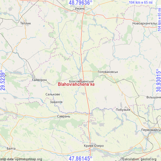
Blahovishchens’ke GPS coordinates[2]
48° 19' 51.78" North, 30° 13' 37.272" East
| Map corner | latitude | longitude |
|---|---|---|
| Upper-left | 48.79636°, | 29.5239° |
| Center: | 48.33105°, | 30.22702° |
| Lower-right: | 47.86145°, | 30.93015° |
| Map W x H: | 104×104 km | = 64.6×64.6mi |
| max Lat: | 52.18903° ⇑49.1% North |
| Blahovishchens’ke: | 48.33105° |
| min Lat: | ⇓50.9% South 44.39214° |
| min Long | Blahovishchens� | max Long |
| 22.20555° | 30.22702° | 40.13222° |
| W 33.5%⇐ | ⇒66.5% E |
Elevation
Elevation of Blahovishchens’ke is 125 m = 410 ft, and this is 30.8 m = 101 ft below average elevation for this country.
| Max E: |
886 m = 2907 ft | 53.1% |
| Avg. | 155.8 m = 511 ft | |
| Blahovishchens’ke | 125 m = 410 ft | |
Min E: |
-3 m = -10 ft | 46.9% |
See also: Ukraine elevation on elevation.city.
Geographical zone
Blahovishchens’ke is located in North temperate zone (between Tropic of Cancer and the Arctic Circle). Distance of this North polar circle is 2027.3 km =1259.7 mi to North.| Distance of | km | miles | from Blahovishchens’ke |
|---|---|---|---|
| North Pole | 4633.2 | 2878.9 | to North |
| Arctic Circle | 2027.3 | 1259.7 | to North |
| Tropic Cancer | 2768 | 1720 | to South |
| Equator | 5373.9 | 3339.2 | to South |


Nearby cities:
15 places around Blahovishchens’ke: (largest is in red/bold)
• Babanka
45.1 km =28 mi,  21°
21°
• Bershad
52.6 km =32.7 mi,  274°
274°
• Hayvoron
26.6 km =16.5 mi, 272°
• Holovanivs’k
18.3 km =11.4 mi,  71°
71°
• Kryve Ozero
43.1 km =26.8 mi,  167°
167°
• Perehonivka
31.3 km =19.4 mi,  43°
43°
• Peschana
43.1 km =26.8 mi,  238°
238°
• Pobugskoye
32.7 km =20.3 mi,  124°
124°
• Savran
24.6 km =15.3 mi,  205°
205°
• Tanske
52.8 km =32.8 mi,  13°
13°
• Teplyk
51.4 km =31.9 mi,  316°
316°
• Uman
46.4 km =28.8 mi,  359°
359°
• Vil’shanka
49.2 km =30.6 mi,  102°
102°
• Viytivka
51.6 km =32.1 mi,  281°
281°
• Zavallya
20.4 km =12.7 mi,  230°
230°
Sources, notices
• [Note1] Compared only with cities in Ukraine existing in our database
• [Src1] Map data: © OpenStreetMap contributors (CC-BY-SA)
• [Src2] Other city data from geonames.org with taken over terms of usage.
• [Src3] Geographical zone / Annual Mean Temperature by Robert A. Rohde @ Wikipedia
