Holovanivs’k geodata
Holovanivs’k (Kirovohrad) is a seat of a second-order administrative division; located in Ukraine in Europe/Kiev (GMT+3) time zone. In our database, there are 1661 cities with bigger population. Compared to other cities in Ukraine, 52.2% of cities are located further ↓South; 64.7% of cities are located further →East and 61.6% of cities have lower elevation than Holovanivs’k. Note1


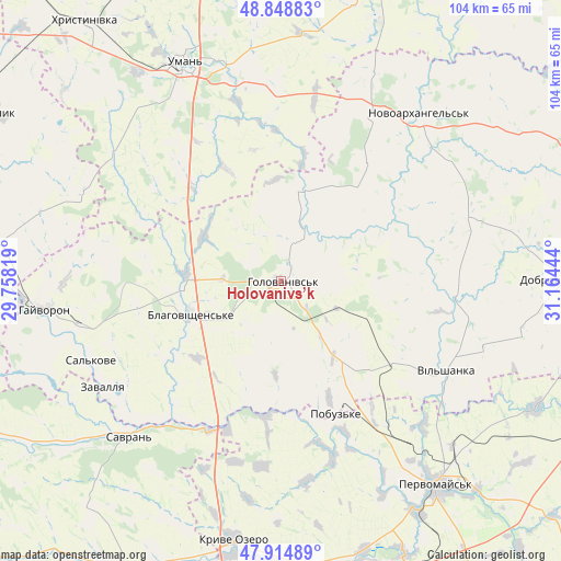
Holovanivs’k GPS coordinates[2]
48° 23' 2.4" North, 30° 27' 40.716" East
| Map corner | latitude | longitude |
|---|---|---|
| Upper-left | 48.84883°, | 29.75819° |
| Center: | 48.384°, | 30.46131° |
| Lower-right: | 47.91489°, | 31.16444° |
| Map W x H: | 103.8×103.8 km | = 64.5×64.5mi |
| max Lat: | 52.18903° ⇑47.8% North |
| Holovanivs’k: | 48.384° |
| min Lat: | ⇓52.2% South 44.39214° |
| min Long | Holovanivs’k | max Long |
| 22.20555° | 30.46131° | 40.13222° |
| W 35.3%⇐ | ⇒64.7% E |
Elevation
Elevation of Holovanivs’k is 174 m = 571 ft, and this is 18.2 m = 60 ft above average elevation for this country.
| Max E: |
886 m = 2907 ft | 38.4% |
| Holovanivs’k | 174 m 571 ft | |
| Avg. | 155.8 m = 511 ft | |
Min E: |
-3 m = -10 ft | 61.6% |
See also: Ukraine elevation on elevation.city.
Geographical zone
Holovanivs’k is located in North temperate zone (between Tropic of Cancer and the Arctic Circle). Distance of this North polar circle is 2021.4 km =1256 mi to North.| Distance of | km | miles | from Holovanivs’k |
|---|---|---|---|
| North Pole | 4627.3 | 2875.3 | to North |
| Arctic Circle | 2021.4 | 1256 | to North |
| Tropic Cancer | 2773.9 | 1723.6 | to South |
| Equator | 5379.8 | 3342.9 | to South |


Nearby cities:
15 places around Holovanivs’k: (largest is in red/bold)
• Babanka
36.2 km =22.5 mi,  358°
358°
• Blahovishchens’ke
18.3 km =11.4 mi,  251°
251°
• Hayvoron
44.1 km =27.4 mi,  263°
263°
• Lypnyazhka
45.9 km =28.5 mi,  81°
81°
• Novoarkhanhel’s’k
40.2 km =25 mi,  40°
40°
• Perehonivka
17.4 km =10.8 mi,  14°
14°
• Pervomays’k
47.5 km =29.5 mi,  142°
142°
• Pidhorodna
44.2 km =27.5 mi,  134°
134°
• Pobugskoye
26.1 km =16.2 mi,  158°
158°
• Savran
39.6 km =24.6 mi,  225°
225°
• Tanske
45.8 km =28.5 mi,  353°
353°
• Tyshkivka
37.6 km =23.4 mi,  70°
70°
• Uman
44.2 km =27.5 mi,  336°
336°
• Vil’shanka
34.8 km =21.6 mi,  118°
118°
• Zavallya
38 km =23.6 mi,  240°
240°
Sources, notices
• [Note1] Compared only with cities in Ukraine existing in our database
• [Src1] Map data: © OpenStreetMap contributors (CC-BY-SA)
• [Src2] Other city data from geonames.org with taken over terms of usage.
• [Src3] Geographical zone / Annual Mean Temperature by Robert A. Rohde @ Wikipedia
