Perehonivka geodata
Perehonivka (Kirovohrad) is a populated place; located in Ukraine in Europe/Kiev (GMT+3) time zone. With population of 3,354 people, there are 857 cities with bigger population in this country. Compared to other cities in Ukraine, 56.3% of cities are located further ↓South; 64.3% of cities are located further →East and 55.7% of cities have higher elevation than Perehonivka. Note1


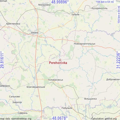
Perehonivka GPS coordinates[2]
48° 32' 7.872" North, 30° 31' 9.228" East
| Map corner | latitude | longitude |
|---|---|---|
| Upper-left | 48.99896°, | 29.81611° |
| Center: | 48.53552°, | 30.51923° |
| Lower-right: | 48.0678°, | 31.22236° |
| Map W x H: | 103.5×103.5 km | = 64.3×64.3mi |
| max Lat: | 52.18903° ⇑43.7% North |
| Perehonivka: | 48.53552° |
| min Lat: | ⇓56.3% South 44.39214° |
| min Long | Perehonivka | max Long |
| 22.20555° | 30.51923° | 40.13222° |
| W 35.7%⇐ | ⇒64.3% E |
Elevation
Elevation of Perehonivka is 118 m = 387 ft, and this is 37.8 m = 124 ft below average elevation for this country.
| Max E: |
886 m = 2907 ft | 55.7% |
| Avg. | 155.8 m = 511 ft | |
| Perehonivka | 118 m = 387 ft | |
Min E: |
-3 m = -10 ft | 44.3% |
See also: Ukraine elevation on elevation.city.
Geographical zone
Perehonivka is located in North temperate zone (between Tropic of Cancer and the Arctic Circle). Distance of this North polar circle is 2004.5 km =1245.5 mi to North.| Distance of | km | miles | from Perehonivka |
|---|---|---|---|
| North Pole | 4610.4 | 2864.8 | to North |
| Arctic Circle | 2004.5 | 1245.5 | to North |
| Tropic Cancer | 2790.7 | 1734.1 | to South |
| Equator | 5396.6 | 3353.3 | to South |


Nearby cities:
15 places around Perehonivka: (largest is in red/bold)
• Babanka
20.1 km =12.5 mi,  344°
344°
• Blahovishchens’ke
31.3 km =19.4 mi,  223°
223°
• Hlybochok
42.2 km =26.2 mi,  29°
29°
• Holovanivs’k
17.4 km =10.8 mi,  194°
194°
• Khrystynivka
50.6 km =31.4 mi,  308°
308°
• Lypnyazhka
42.2 km =26.2 mi,  103°
103°
• Mankivka
49.5 km =30.8 mi, 344°
• Novoarkhanhel’s’k
25.9 km =16.1 mi,  58°
58°
• Pobugskoye
41.5 km =25.8 mi,  172°
172°
• Talne
41.3 km =25.7 mi,  18°
18°
• Tanske
30.1 km =18.7 mi, 341°
• Tyshkivka
31.5 km =19.6 mi, 97°
• Uman
32.2 km =20 mi,  317°
317°
• Verkhniachka
48 km =29.8 mi, 312°
• Vil’shanka
42.5 km =26.4 mi,  141°
141°
Sources, notices
• [Note1] Compared only with cities in Ukraine existing in our database
• [Src1] Map data: © OpenStreetMap contributors (CC-BY-SA)
• [Src2] Other city data from geonames.org with taken over terms of usage.
• [Src3] Geographical zone / Annual Mean Temperature by Robert A. Rohde @ Wikipedia
