Nyzhnya Duvanka geodata
Nyzhnya Duvanka (Luhansk) is a populated place; located in Ukraine in Europe/Zaporozhye (GMT+3) time zone. With population of 2,353 people, there are 1052 cities with bigger population in this country. Compared to other cities in Ukraine, 76% of cities are located further ↓South; 95.3% of cities are located further ←West and 68.4% of cities have higher elevation than Nyzhnya Duvanka. Note1


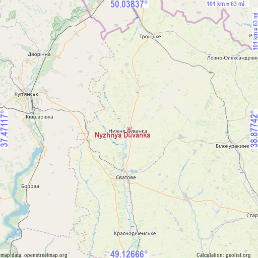
Nyzhnya Duvanka GPS coordinates[2]
49° 35' 4.704" North, 38° 10' 27.444" East
| Map corner | latitude | longitude |
|---|---|---|
| Upper-left | 50.03837°, | 37.47117° |
| Center: | 49.58464°, | 38.17429° |
| Lower-right: | 49.12666°, | 38.87742° |
| Map W x H: | 101.4×101.4 km | = 63×63mi |
| max Lat: | 52.18903° ⇑24% North |
| Nyzhnya Duvanka: | 49.58464° |
| min Lat: | ⇓76% South 44.39214° |
| min Long | Nyzhnya Duvanka | max Long |
| 22.20555° | 38.17429° | 40.13222° |
| W 95.3%⇐ | ⇒4.7% E |
Elevation
Elevation of Nyzhnya Duvanka is 79 m = 259 ft, and this is 76.8 m = 252 ft below average elevation for this country.
| Max E: |
886 m = 2907 ft | 68.4% |
| Avg. | 155.8 m = 511 ft | |
| Nyzhnya Duvanka | 79 m = 259 ft | |
Min E: |
-3 m = -10 ft | 31.6% |
See also: Ukraine elevation on elevation.city.
Geographical zone
Nyzhnya Duvanka is located in North temperate zone (between Tropic of Cancer and the Arctic Circle). Distance of this North polar circle is 1887.9 km =1173.1 mi to North.| Distance of | km | miles | from Nyzhnya Duvanka |
|---|---|---|---|
| North Pole | 4493.8 | 2792.3 | to North |
| Arctic Circle | 1887.9 | 1173.1 | to North |
| Tropic Cancer | 2907.4 | 1806.6 | to South |
| Equator | 5513.3 | 3425.8 | to South |


Nearby cities:
15 places around Nyzhnya Duvanka: (largest is in red/bold)
• Bilokurakyne
40.5 km =25.2 mi,  97°
97°
• Borova
46.1 km =28.6 mi,  240°
240°
• Dvorichna
46.1 km =28.6 mi,  309°
309°
• Kivsharivka
35.4 km =22 mi,  278°
278°
• Kreminna
59.6 km =37 mi,  176°
176°
• Kupjansk
42.6 km =26.5 mi,  289°
289°
• Lozno-Oleksandrivka
49.6 km =30.8 mi,  55°
55°
• Pavlivka
38.6 km =24 mi,  86°
86°
• Pryvillya
64 km =39.8 mi,  171°
171°
• Starobil’s’k
63.2 km =39.3 mi,  122°
122°
• Svatove
19.5 km =12.1 mi,  185°
185°
• Terny
56.9 km =35.4 mi,  195°
195°
• Troyits’ke
37.7 km =23.4 mi,  13°
13°
• Yats’kivka
65.1 km =40.5 mi,  226°
226°
• Zarichne
64.8 km =40.3 mi, 195°
Sources, notices
• [Note1] Compared only with cities in Ukraine existing in our database
• [Src1] Map data: © OpenStreetMap contributors (CC-BY-SA)
• [Src2] Other city data from geonames.org with taken over terms of usage.
• [Src3] Geographical zone / Annual Mean Temperature by Robert A. Rohde @ Wikipedia
