Svatove geodata
Svatove (Luhansk) is a seat of a second-order administrative division; located in Ukraine in Europe/Zaporozhye (GMT+3) time zone. With population of 18,770 people, there are 214 cities with bigger population in this country. Compared to other cities in Ukraine, 73% of cities are located further ↓South; 95.2% of cities are located further ←West and 71.8% of cities have higher elevation than Svatove. Note1


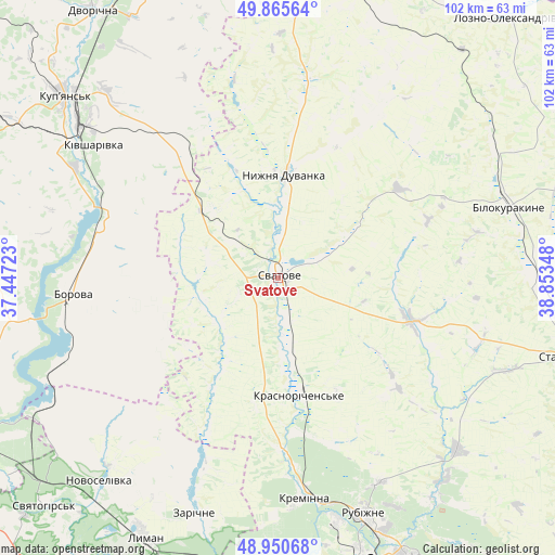
Svatove GPS coordinates[2]
49° 24' 37.044" North, 38° 9' 1.26" East
| Map corner | latitude | longitude |
|---|---|---|
| Upper-left | 49.86564°, | 37.44723° |
| Center: | 49.41029°, | 38.15035° |
| Lower-right: | 48.95068°, | 38.85348° |
| Map W x H: | 101.7×101.7 km | = 63.2×63.2mi |
| max Lat: | 52.18903° ⇑27% North |
| Svatove: | 49.41029° |
| min Lat: | ⇓73% South 44.39214° |
| min Long | Svatove | max Long |
| 22.20555° | 38.15035° | 40.13222° |
| W 95.2%⇐ | ⇒4.8% E |
Elevation
Elevation of Svatove is 70 m = 230 ft, and this is 85.8 m = 281 ft below average elevation for this country.
| Max E: |
886 m = 2907 ft | 71.8% |
| Avg. | 155.8 m = 511 ft | |
| Svatove | 70 m = 230 ft | |
Min E: |
-3 m = -10 ft | 28.2% |
See also: Ukraine elevation on elevation.city.
Geographical zone
Svatove is located in North temperate zone (between Tropic of Cancer and the Arctic Circle). Distance of this North polar circle is 1907.3 km =1185.1 mi to North.| Distance of | km | miles | from Svatove |
|---|---|---|---|
| North Pole | 4513.2 | 2804.4 | to North |
| Arctic Circle | 1907.3 | 1185.1 | to North |
| Tropic Cancer | 2888 | 1794.5 | to South |
| Equator | 5493.9 | 3413.8 | to South |


Nearby cities:
15 places around Svatove: (largest is in red/bold)
• Bilokurakyne
44.1 km =27.4 mi,  71°
71°
• Borova
38.5 km =23.9 mi,  264°
264°
• Drobysheve
51.1 km =31.8 mi,  216°
216°
• Kivsharivka
41.4 km =25.7 mi,  306°
306°
• Kreminna
40.4 km =25.1 mi,  173°
173°
• Kupjansk
51 km =31.7 mi, 310°
• Lyman
53.3 km =33.1 mi,  208°
208°
• Novoselivka
50.2 km =31.2 mi, 221°
• Nyzhnya Duvanka
19.5 km =12.1 mi,  5°
5°
• Pavlivka
46 km =28.6 mi,  61°
61°
• Pryvillya
45.4 km =28.2 mi, 165°
• Rubizhne
47.3 km =29.4 mi,  159°
159°
• Terny
37.9 km =23.5 mi,  201°
201°
• Yats’kivka
52.2 km =32.4 mi,  240°
240°
• Zarichne
45.9 km =28.5 mi, 200°
Sources, notices
• [Note1] Compared only with cities in Ukraine existing in our database
• [Src1] Map data: © OpenStreetMap contributors (CC-BY-SA)
• [Src2] Other city data from geonames.org with taken over terms of usage.
• [Src3] Geographical zone / Annual Mean Temperature by Robert A. Rohde @ Wikipedia
