Milove geodata
Milove (Luhansk) is a seat of a second-order administrative division; located in Ukraine in Europe/Zaporozhye (GMT+3) time zone. With population of 5,418 people, there are 613 cities with bigger population in this country. Compared to other cities in Ukraine, 72% of cities are located further ↓South; 100% of cities are located further ←West and 64.9% of cities have lower elevation than Milove. Note1


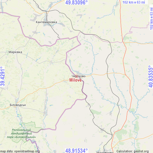
Milove GPS coordinates[2]
49° 22' 31.008" North, 40° 7' 55.992" East
| Map corner | latitude | longitude |
|---|---|---|
| Upper-left | 49.83096°, | 39.4291° |
| Center: | 49.37528°, | 40.13222° |
| Lower-right: | 48.91534°, | 40.83535° |
| Map W x H: | 101.8×101.8 km | = 63.3×63.3mi |
| max Lat: | 52.18903° ⇑28% North |
| Milove: | 49.37528° |
| min Lat: | ⇓72% South 44.39214° |
| min Long | Milove | max Long |
| 22.20555° | 40.13222° | 40.13222° |
| W 100%⇐ | ⇒0% E |
Elevation
Elevation of Milove is 185 m = 607 ft, and this is 29.2 m = 96 ft above average elevation for this country.
| Max E: |
886 m = 2907 ft | 35.1% |
| Milove | 185 m 607 ft | |
| Avg. | 155.8 m = 511 ft | |
Min E: |
-3 m = -10 ft | 64.9% |
See also: Ukraine elevation on elevation.city.
Geographical zone
Milove is located in North temperate zone (between Tropic of Cancer and the Arctic Circle). Distance of this North polar circle is 1911.2 km =1187.6 mi to North.| Distance of | km | miles | from Milove |
|---|---|---|---|
| North Pole | 4517 | 2806.7 | to North |
| Arctic Circle | 1911.2 | 1187.6 | to North |
| Tropic Cancer | 2884.1 | 1792.1 | to South |
| Equator | 5490 | 3411.3 | to South |


Nearby cities:
15 places around Milove: (largest is in red/bold)
• Bilokurakyne
102.8 km =63.9 mi,  279°
279°
• Bilovods'k
43.5 km =27 mi,  244°
244°
• Lozno-Oleksandrivka
112.7 km =70 mi,  297°
297°
• Luhansk
107.8 km =67 mi,  213°
213°
• Makariv Yar
93.7 km =58.2 mi,  198°
198°
• Markivka
43.8 km =27.2 mi,  292°
292°
• Novoaydar
93.8 km =58.3 mi, 240°
• Novopskov
77.7 km =48.3 mi, 284°
• Pavlivka
106 km =65.9 mi, 284°
• Rozkishne
116.5 km =72.4 mi, 212°
• Shchastya
96.4 km =59.9 mi,  222°
222°
• Slov`yanoserbsk
112.7 km =70 mi,  228°
228°
• Stanytsya Luhans’ka
93.2 km =57.9 mi, 210°
• Starobil’s’k
89.2 km =55.4 mi,  263°
263°
• Tr’okhizbenka
109.4 km =68 mi, 231°
Sources, notices
• [Note1] Compared only with cities in Ukraine existing in our database
• [Src1] Map data: © OpenStreetMap contributors (CC-BY-SA)
• [Src2] Other city data from geonames.org with taken over terms of usage.
• [Src3] Geographical zone / Annual Mean Temperature by Robert A. Rohde @ Wikipedia
