Kolochava geodata
Kolochava (Transcarpathia) is a populated place; located in Ukraine in Europe/Uzhgorod (GMT+3) time zone. With population of 4,839 people, there are 671 cities with bigger population in this country. Compared to other cities in Ukraine, 53.2% of cities are located further ↓South; 94.4% of cities are located further →East and 98.8% of cities have lower elevation than Kolochava. Note1


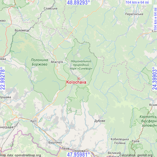
Kolochava GPS coordinates[2]
48° 25' 42.636" North, 23° 41' 45.24" East
| Map corner | latitude | longitude |
|---|---|---|
| Upper-left | 48.89293°, | 22.99278° |
| Center: | 48.42851°, | 23.6959° |
| Lower-right: | 47.95981°, | 24.39903° |
| Map W x H: | 103.8×103.8 km | = 64.5×64.5mi |
| max Lat: | 52.18903° ⇑46.8% North |
| Kolochava: | 48.42851° |
| min Lat: | ⇓53.2% South 44.39214° |
| min Long | Kolochava | max Long |
| 22.20555° | 23.6959° | 40.13222° |
| W 5.6%⇐ | ⇒94.4% E |
Elevation
Elevation of Kolochava is 550 m = 1804 ft, and this is 394.2 m = 1293 ft above average elevation for this country.
| Max E: |
886 m = 2907 ft | 1.2% |
| Kolochava | 550 m 1804 ft | |
| Avg. | 155.8 m = 511 ft | |
Min E: |
-3 m = -10 ft | 98.8% |
See also: Ukraine elevation on elevation.city.
Geographical zone
Kolochava is located in North temperate zone (between Tropic of Cancer and the Arctic Circle). Distance of this North polar circle is 2016.4 km =1252.9 mi to North.| Distance of | km | miles | from Kolochava |
|---|---|---|---|
| North Pole | 4622.3 | 2872.2 | to North |
| Arctic Circle | 2016.4 | 1252.9 | to North |
| Tropic Cancer | 2778.8 | 1726.7 | to South |
| Equator | 5384.7 | 3345.9 | to South |


Nearby cities:
15 places around Kolochava: (largest is in red/bold)
• Berezovo
21.1 km =13.1 mi,  231°
231°
• Dovhe
31.6 km =19.6 mi,  257°
257°
• Drahovo
24 km =14.9 mi,  206°
206°
• Dubove
31.9 km =19.8 mi,  153°
153°
• Horinchovo
26.1 km =16.2 mi, 227°
• Kalyny
34.6 km =21.5 mi,  157°
157°
• Kopashnovo
28 km =17.4 mi, 213°
• Kushnytsya
32.3 km =20.1 mi,  272°
272°
• Lopukhiv
21 km =13 mi,  109°
109°
• Lypcha
29.7 km =18.5 mi, 231°
• Lysychovo
30.9 km =19.2 mi,  284°
284°
• Mizhhirya
17.6 km =10.9 mi,  307°
307°
• Nyzhnye Selyshche
31.4 km =19.5 mi,  215°
215°
• Synevyr
8.3 km =5.2 mi,  321°
321°
• Synevyrska Poliana
17.4 km =10.8 mi,  358°
358°
Sources, notices
• [Note1] Compared only with cities in Ukraine existing in our database
• [Src1] Map data: © OpenStreetMap contributors (CC-BY-SA)
• [Src2] Other city data from geonames.org with taken over terms of usage.
• [Src3] Geographical zone / Annual Mean Temperature by Robert A. Rohde @ Wikipedia
