Savran geodata
Savran (Odesa) is a seat of a second-order administrative division; located in Ukraine in Europe/Kiev (GMT+3) time zone. With population of 7,000 people, there are 509 cities with bigger population in this country. Compared to other cities in Ukraine, 53.9% of cities are located further ↑North; 67.3% of cities are located further →East and 63.9% of cities have higher elevation than Savran. Note1


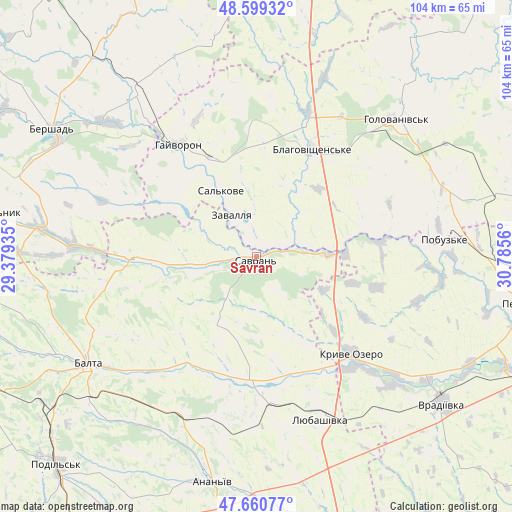
Savran GPS coordinates[2]
48° 7' 55.884" North, 30° 4' 56.892" East
| Map corner | latitude | longitude |
|---|---|---|
| Upper-left | 48.59932°, | 29.37935° |
| Center: | 48.13219°, | 30.08247° |
| Lower-right: | 47.66077°, | 30.7856° |
| Map W x H: | 104.4×104.4 km | = 64.9×64.9mi |
| max Lat: | 52.18903° ⇑53.9% North |
| Savran: | 48.13219° |
| min Lat: | ⇓46.1% South 44.39214° |
| min Long | Savran | max Long |
| 22.20555° | 30.08247° | 40.13222° |
| W 32.7%⇐ | ⇒67.3% E |
Elevation
Elevation of Savran is 94 m = 308 ft, and this is 61.8 m = 203 ft below average elevation for this country.
| Max E: |
886 m = 2907 ft | 63.9% |
| Avg. | 155.8 m = 511 ft | |
| Savran | 94 m = 308 ft | |
Min E: |
-3 m = -10 ft | 36.1% |
See also: Ukraine elevation on elevation.city.
Geographical zone
Savran is located in North temperate zone (between Tropic of Cancer and the Arctic Circle). Distance of this North polar circle is 2049.4 km =1273.4 mi to North.| Distance of | km | miles | from Savran |
|---|---|---|---|
| North Pole | 4655.3 | 2892.7 | to North |
| Arctic Circle | 2049.4 | 1273.4 | to North |
| Tropic Cancer | 2745.9 | 1706.2 | to South |
| Equator | 5351.8 | 3325.5 | to South |


Nearby cities:
15 places around Savran: (largest is in red/bold)
• Ananyiv Pershyi
46.8 km =29.1 mi,  192°
192°
• Balta
40.8 km =25.4 mi,  237°
237°
• Bershad
49.4 km =30.7 mi,  302°
302°
• Blahovishchens’ke
24.6 km =15.3 mi,  25°
25°
• Chechelnyk
53.8 km =33.4 mi,  279°
279°
• Hayvoron
28 km =17.4 mi,  325°
325°
• Holovanivs’k
39.6 km =24.6 mi,  45°
45°
• Kryve Ozero
28.2 km =17.5 mi,  135°
135°
• Lyubashivka
35.4 km =22 mi,  158°
158°
• Perehonivka
55.3 km =34.4 mi,  35°
35°
• Peschana
26.1 km =16.2 mi,  269°
269°
• Pobugskoye
38 km =23.6 mi,  84°
84°
• Viytivka
51.6 km =32.1 mi,  309°
309°
• Vradiyivka
48.4 km =30.1 mi,  128°
128°
• Zavallya
10.3 km =6.4 mi, 331°
Sources, notices
• [Note1] Compared only with cities in Ukraine existing in our database
• [Src1] Map data: © OpenStreetMap contributors (CC-BY-SA)
• [Src2] Other city data from geonames.org with taken over terms of usage.
• [Src3] Geographical zone / Annual Mean Temperature by Robert A. Rohde @ Wikipedia
