Kozova geodata
Kozova (Ternopil) is a seat of a second-order administrative division; located in Ukraine in Europe/Kiev (GMT+3) time zone. With population of 9,019 people, there are 398 cities with bigger population in this country. Compared to other cities in Ukraine, 73.5% of cities are located further ↓South; 85.3% of cities are located further →East and 94.9% of cities have lower elevation than Kozova. Note1


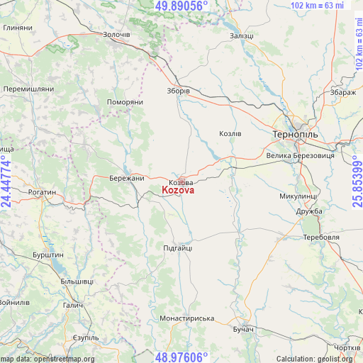
Kozova GPS coordinates[2]
49° 26' 7.584" North, 25° 9' 3.096" East
| Map corner | latitude | longitude |
|---|---|---|
| Upper-left | 49.89056°, | 24.44774° |
| Center: | 49.43544°, | 25.15086° |
| Lower-right: | 48.97606°, | 25.85399° |
| Map W x H: | 101.7×101.7 km | = 63.2×63.2mi |
| max Lat: | 52.18903° ⇑26.5% North |
| Kozova: | 49.43544° |
| min Lat: | ⇓73.5% South 44.39214° |
| min Long | Kozova | max Long |
| 22.20555° | 25.15086° | 40.13222° |
| W 14.7%⇐ | ⇒85.3% E |
Elevation
Elevation of Kozova is 361 m = 1184 ft, and this is 205.2 m = 673 ft above average elevation for this country.
| Max E: |
886 m = 2907 ft | 5.1% |
| Kozova | 361 m 1184 ft | |
| Avg. | 155.8 m = 511 ft | |
Min E: |
-3 m = -10 ft | 94.9% |
See also: Ukraine elevation on elevation.city.
Geographical zone
Kozova is located in North temperate zone (between Tropic of Cancer and the Arctic Circle). Distance of this North polar circle is 1904.5 km =1183.4 mi to North.| Distance of | km | miles | from Kozova |
|---|---|---|---|
| North Pole | 4510.4 | 2802.6 | to North |
| Arctic Circle | 1904.5 | 1183.4 | to North |
| Tropic Cancer | 2890.8 | 1796.3 | to South |
| Equator | 5496.7 | 3415.5 | to South |


Nearby cities:
15 places around Kozova: (largest is in red/bold)
• Bilshivtsi
40.4 km =25.1 mi,  226°
226°
• Chesniki
31.1 km =19.3 mi,  260°
260°
• Dunayiv
31 km =19.3 mi,  310°
310°
• Mikulintsy
33.2 km =20.6 mi,  97°
97°
• Monastyrys’ka
38.5 km =23.9 mi,  177°
177°
• Nadrichne
17.6 km =10.9 mi, 308°
• Ozerna
25.1 km =15.6 mi,  30°
30°
• Petrikov
32.7 km =20.3 mi,  70°
70°
• Pidhaytsi
18.6 km =11.6 mi, 183°
• Pomoriany
27.8 km =17.3 mi,  325°
325°
• Ray
17.5 km =10.9 mi,  269°
269°
• Rohatyn
39.3 km =24.4 mi, 265°
• Ternopil
34.3 km =21.3 mi, 67°
• Zboriv
25.5 km =15.8 mi,  358°
358°
• Бережани
15.8 km =9.8 mi,  275°
275°
Sources, notices
• [Note1] Compared only with cities in Ukraine existing in our database
• [Src1] Map data: © OpenStreetMap contributors (CC-BY-SA)
• [Src2] Other city data from geonames.org with taken over terms of usage.
• [Src3] Geographical zone / Annual Mean Temperature by Robert A. Rohde @ Wikipedia
