Dolyns'ka geodata
Dolyns'ka (Kirovohrad) is a populated place; located in Ukraine in Europe/Kiev (GMT+3) time zone. With population of 34,267 people, there are 129 cities with bigger population in this country. Compared to other cities in Ukraine, 54.6% of cities are located further ↑North; 53.8% of cities are located further →East and 66.8% of cities have lower elevation than Dolyns'ka. Note1


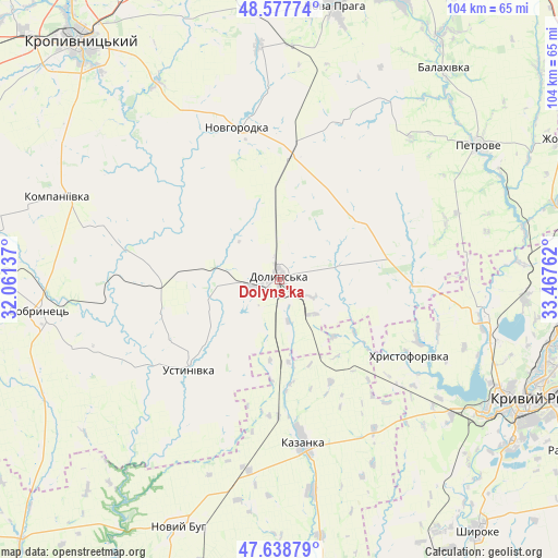
Dolyns'ka GPS coordinates[2]
48° 6' 37.476" North, 32° 45' 52.164" East
| Map corner | latitude | longitude |
|---|---|---|
| Upper-left | 48.57774°, | 32.06137° |
| Center: | 48.11041°, | 32.76449° |
| Lower-right: | 47.63879°, | 33.46762° |
| Map W x H: | 104.4×104.4 km | = 64.9×64.9mi |
| max Lat: | 52.18903° ⇑54.6% North |
| Dolyns'ka: | 48.11041° |
| min Lat: | ⇓45.4% South 44.39214° |
| min Long | Dolyns'ka | max Long |
| 22.20555° | 32.76449° | 40.13222° |
| W 46.2%⇐ | ⇒53.8% E |
Elevation
Elevation of Dolyns'ka is 193 m = 633 ft, and this is 37.2 m = 122 ft above average elevation for this country.
| Max E: |
886 m = 2907 ft | 33.2% |
| Dolyns'ka | 193 m 633 ft | |
| Avg. | 155.8 m = 511 ft | |
Min E: |
-3 m = -10 ft | 66.8% |
See also: Ukraine elevation on elevation.city.
Geographical zone
Dolyns'ka is located in North temperate zone (between Tropic of Cancer and the Arctic Circle). Distance of this North polar circle is 2051.8 km =1274.9 mi to North.| Distance of | km | miles | from Dolyns'ka |
|---|---|---|---|
| North Pole | 4657.7 | 2894.2 | to North |
| Arctic Circle | 2051.8 | 1274.9 | to North |
| Tropic Cancer | 2743.5 | 1704.7 | to South |
| Equator | 5349.4 | 3324 | to South |


Nearby cities:
15 places around Dolyns'ka: (largest is in red/bold)
• Adzhamka
50.9 km =31.6 mi,  340°
340°
• Bobrynets
44.8 km =27.8 mi,  262°
262°
• Kazanka
29.7 km =18.5 mi,  171°
171°
• Kompaniyivka
44.1 km =27.4 mi,  290°
290°
• Kropyvnytskyi
58.3 km =36.2 mi,  320°
320°
• Kryvyi Rih
51 km =31.7 mi,  115°
115°
• Lozuvatka
39.2 km =24.4 mi,  98°
98°
• Molodizhne
10.7 km =6.6 mi,  313°
313°
• Nova Praha
51.9 km =32.2 mi,  11°
11°
• Novhorodka
29.4 km =18.3 mi, 344°
• Novyy Buh
49.8 km =30.9 mi,  201°
201°
• Novyy Starodub
54.3 km =33.7 mi,  33°
33°
• Oleksandriys’ke
57.6 km =35.8 mi,  16°
16°
• Petrove
43.5 km =27 mi,  56°
56°
• Ustynivka
24.2 km =15 mi,  224°
224°
Sources, notices
• [Note1] Compared only with cities in Ukraine existing in our database
• [Src1] Map data: © OpenStreetMap contributors (CC-BY-SA)
• [Src2] Other city data from geonames.org with taken over terms of usage.
• [Src3] Geographical zone / Annual Mean Temperature by Robert A. Rohde @ Wikipedia
