Lozuvatka geodata
Lozuvatka (Kirovohrad) is a populated place; located in Ukraine in Europe/Kiev (GMT+3) time zone. With population of 6,412 people, there are 545 cities with bigger population in this country. Compared to other cities in Ukraine, 55.4% of cities are located further ↑North; 50.3% of cities are located further →East and 65.4% of cities have higher elevation than Lozuvatka. Note1


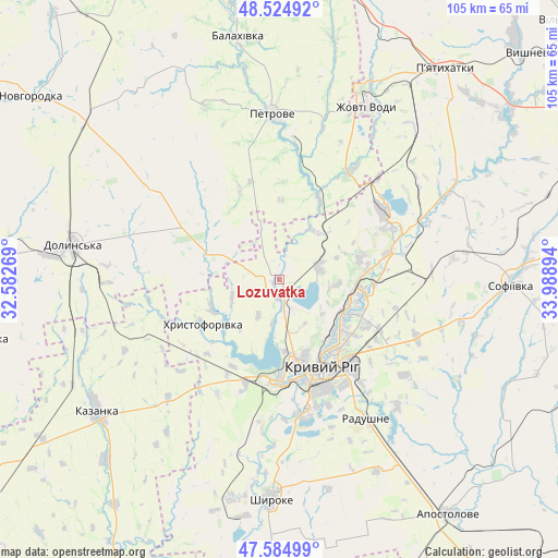
Lozuvatka GPS coordinates[2]
48° 3' 25.56" North, 33° 17' 8.916" East
| Map corner | latitude | longitude |
|---|---|---|
| Upper-left | 48.52492°, | 32.58269° |
| Center: | 48.0571°, | 33.28581° |
| Lower-right: | 47.58499°, | 33.98894° |
| Map W x H: | 104.5×104.5 km | = 64.9×64.9mi |
| max Lat: | 52.18903° ⇑55.4% North |
| Lozuvatka: | 48.0571° |
| min Lat: | ⇓44.6% South 44.39214° |
| min Long | Lozuvatka | max Long |
| 22.20555° | 33.28581° | 40.13222° |
| W 49.7%⇐ | ⇒50.3% E |
Elevation
Elevation of Lozuvatka is 88 m = 289 ft, and this is 67.8 m = 222 ft below average elevation for this country.
| Max E: |
886 m = 2907 ft | 65.4% |
| Avg. | 155.8 m = 511 ft | |
| Lozuvatka | 88 m = 289 ft | |
Min E: |
-3 m = -10 ft | 34.6% |
See also: Ukraine elevation on elevation.city.
Geographical zone
Lozuvatka is located in North temperate zone (between Tropic of Cancer and the Arctic Circle). Distance of this North polar circle is 2057.7 km =1278.6 mi to North.| Distance of | km | miles | from Lozuvatka |
|---|---|---|---|
| North Pole | 4663.6 | 2897.8 | to North |
| Arctic Circle | 2057.7 | 1278.6 | to North |
| Tropic Cancer | 2737.5 | 1701 | to South |
| Equator | 5343.4 | 3320.2 | to South |


Nearby cities:
15 places around Lozuvatka: (largest is in red/bold)
• Apostolove
54.5 km =33.9 mi,  144°
144°
• Dolyns'ka
39.2 km =24.4 mi,  278°
278°
• Kazanka
41.8 km =26 mi,  235°
235°
• Kryvyi Rih
17.8 km =11.1 mi,  156°
156°
• Molodizhne
48.3 km =30 mi,  286°
286°
• Nova Praha
63.5 km =39.5 mi,  333°
333°
• Novhorodka
57.8 km =35.9 mi,  306°
306°
• Novyy Starodub
51.7 km =32.1 mi,  350°
350°
• Petrove
29.8 km =18.5 mi,  355°
355°
• Piatykhatky
50.6 km =31.4 mi,  38°
38°
• Shyroke
40.7 km =25.3 mi,  183°
183°
• Sofiyivka
43.9 km =27.3 mi,  91°
91°
• Ustynivka
56.9 km =35.4 mi,  258°
258°
• Vyshneve
62.9 km =39.1 mi,  47°
47°
• Zhovti Vody
35.8 km =22.2 mi,  26°
26°
Sources, notices
• [Note1] Compared only with cities in Ukraine existing in our database
• [Src1] Map data: © OpenStreetMap contributors (CC-BY-SA)
• [Src2] Other city data from geonames.org with taken over terms of usage.
• [Src3] Geographical zone / Annual Mean Temperature by Robert A. Rohde @ Wikipedia
