Ustynivka geodata
Ustynivka (Kirovohrad) is a seat of a second-order administrative division; located in Ukraine in Europe/Kiev (GMT+3) time zone. With population of 4,003 people, there are 761 cities with bigger population in this country. Compared to other cities in Ukraine, 57.2% of cities are located further ↑North; 55% of cities are located further →East and 66.9% of cities have higher elevation than Ustynivka. Note1


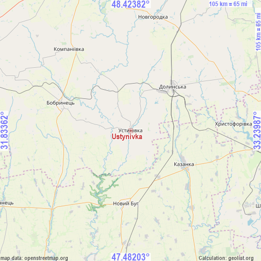
Ustynivka GPS coordinates[2]
47° 57' 18.252" North, 32° 32' 12.264" East
| Map corner | latitude | longitude |
|---|---|---|
| Upper-left | 48.42382°, | 31.83362° |
| Center: | 47.95507°, | 32.53674° |
| Lower-right: | 47.48203°, | 33.23987° |
| Map W x H: | 104.7×104.7 km | = 65.1×65.1mi |
| max Lat: | 52.18903° ⇑57.2% North |
| Ustynivka: | 47.95507° |
| min Lat: | ⇓42.8% South 44.39214° |
| min Long | Ustynivka | max Long |
| 22.20555° | 32.53674° | 40.13222° |
| W 45%⇐ | ⇒55% E |
Elevation
Elevation of Ustynivka is 84 m = 276 ft, and this is 71.8 m = 236 ft below average elevation for this country.
| Max E: |
886 m = 2907 ft | 66.9% |
| Avg. | 155.8 m = 511 ft | |
| Ustynivka | 84 m = 276 ft | |
Min E: |
-3 m = -10 ft | 33.1% |
See also: Ukraine elevation on elevation.city.
Geographical zone
Ustynivka is located in North temperate zone (between Tropic of Cancer and the Arctic Circle). Distance of this North polar circle is 2069.1 km =1285.7 mi to North.| Distance of | km | miles | from Ustynivka |
|---|---|---|---|
| North Pole | 4675 | 2904.9 | to North |
| Arctic Circle | 2069.1 | 1285.7 | to North |
| Tropic Cancer | 2726.2 | 1694 | to South |
| Equator | 5332.1 | 3313.2 | to South |


Nearby cities:
15 places around Ustynivka: (largest is in red/bold)
• Adzhamka
65.3 km =40.6 mi,  359°
359°
• Bashtanka
61.4 km =38.2 mi,  186°
186°
• Bobrynets
29.9 km =18.6 mi,  292°
292°
• Dolyns'ka
24.2 km =15 mi,  44°
44°
• Kazanka
24.5 km =15.2 mi,  119°
119°
• Kompaniyivka
41 km =25.5 mi,  323°
323°
• Kropyvnytskyi
65.4 km =40.6 mi,  341°
341°
• Kryvyi Rih
63.1 km =39.2 mi,  94°
94°
• Lozuvatka
56.9 km =35.4 mi,  78°
78°
• Molodizhne
26.4 km =16.4 mi,  20°
20°
• Novhorodka
46.5 km =28.9 mi,  11°
11°
• Novyy Buh
29.2 km =18.1 mi,  182°
182°
• Rivne
66.6 km =41.4 mi,  299°
299°
• Shyroke
61.2 km =38 mi, 118°
• Yelanets’
58.6 km =36.4 mi,  240°
240°
Sources, notices
• [Note1] Compared only with cities in Ukraine existing in our database
• [Src1] Map data: © OpenStreetMap contributors (CC-BY-SA)
• [Src2] Other city data from geonames.org with taken over terms of usage.
• [Src3] Geographical zone / Annual Mean Temperature by Robert A. Rohde @ Wikipedia
