Kazanka geodata
Kazanka (Mykolaiv) is a seat of a second-order administrative division; located in Ukraine in Europe/Kiev (GMT+3) time zone. With population of 8,010 people, there are 443 cities with bigger population in this country. Compared to other cities in Ukraine, 58.1% of cities are located further ↑North; 53.4% of cities are located further →East and 64.7% of cities have higher elevation than Kazanka. Note1


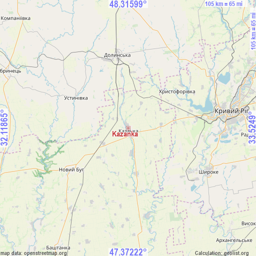
Kazanka GPS coordinates[2]
47° 50' 46.5" North, 32° 49' 18.372" East
| Map corner | latitude | longitude |
|---|---|---|
| Upper-left | 48.31599°, | 32.11865° |
| Center: | 47.84625°, | 32.82177° |
| Lower-right: | 47.37222°, | 33.5249° |
| Map W x H: | 104.9×104.9 km | = 65.2×65.2mi |
| max Lat: | 52.18903° ⇑58.1% North |
| Kazanka: | 47.84625° |
| min Lat: | ⇓41.9% South 44.39214° |
| min Long | Kazanka | max Long |
| 22.20555° | 32.82177° | 40.13222° |
| W 46.6%⇐ | ⇒53.4% E |
Elevation
Elevation of Kazanka is 92 m = 302 ft, and this is 63.8 m = 209 ft below average elevation for this country.
| Max E: |
886 m = 2907 ft | 64.7% |
| Avg. | 155.8 m = 511 ft | |
| Kazanka | 92 m = 302 ft | |
Min E: |
-3 m = -10 ft | 35.3% |
See also: Ukraine elevation on elevation.city.
Geographical zone
Kazanka is located in North temperate zone (between Tropic of Cancer and the Arctic Circle). Distance of this North polar circle is 2081.2 km =1293.2 mi to North.| Distance of | km | miles | from Kazanka |
|---|---|---|---|
| North Pole | 4687.1 | 2912.4 | to North |
| Arctic Circle | 2081.2 | 1293.2 | to North |
| Tropic Cancer | 2714.1 | 1686.5 | to South |
| Equator | 5320 | 3305.7 | to South |


Nearby cities:
15 places around Kazanka: (largest is in red/bold)
• Bashtanka
56.6 km =35.2 mi,  210°
210°
• Bereznehuvate
59.9 km =37.2 mi,  177°
177°
• Bobrynets
54.2 km =33.7 mi,  295°
295°
• Dolyns'ka
29.7 km =18.5 mi,  351°
351°
• Kompaniyivka
64.1 km =39.8 mi,  314°
314°
• Kryvyi Rih
42.3 km =26.3 mi,  80°
80°
• Lozuvatka
41.8 km =26 mi,  55°
55°
• Molodizhne
38.7 km =24 mi,  341°
341°
• Novhorodka
59 km =36.7 mi, 348°
• Novyy Buh
28.2 km =17.5 mi,  232°
232°
• Petrove
62.2 km =38.6 mi,  31°
31°
• Shyroke
36.8 km =22.9 mi,  117°
117°
• Ustynivka
24.5 km =15.2 mi, 299°
• Velyka Oleksandrivka
68.8 km =42.8 mi,  148°
148°
• Vysokopillya
66.1 km =41.1 mi,  126°
126°
Sources, notices
• [Note1] Compared only with cities in Ukraine existing in our database
• [Src1] Map data: © OpenStreetMap contributors (CC-BY-SA)
• [Src2] Other city data from geonames.org with taken over terms of usage.
• [Src3] Geographical zone / Annual Mean Temperature by Robert A. Rohde @ Wikipedia
