Brovky Pershi geodata
Brovky Pershi (Zhytomyr) is a populated place; located in Ukraine in Europe/Kiev (GMT+3) time zone. With population of 961 people, there are 1402 cities with bigger population in this country. Compared to other cities in Ukraine, 82.3% of cities are located further ↓South; 71.8% of cities are located further →East and 77.2% of cities have lower elevation than Brovky Pershi. Note1


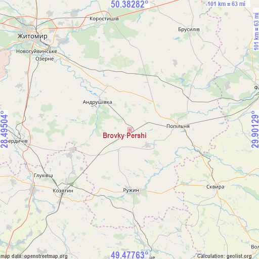
Brovky Pershi GPS coordinates[2]
49° 55' 56.46" North, 29° 11' 53.376" East
| Map corner | latitude | longitude |
|---|---|---|
| Upper-left | 50.38282°, | 28.49504° |
| Center: | 49.93235°, | 29.19816° |
| Lower-right: | 49.47763°, | 29.90129° |
| Map W x H: | 100.6×100.6 km | = 62.5×62.5mi |
| max Lat: | 52.18903° ⇑17.7% North |
| Brovky Pershi: | 49.93235° |
| min Lat: | ⇓82.3% South 44.39214° |
| min Long | Brovky Pershi | max Long |
| 22.20555° | 29.19816° | 40.13222° |
| W 28.2%⇐ | ⇒71.8% E |
Elevation
Elevation of Brovky Pershi is 235 m = 771 ft, and this is 79.2 m = 260 ft above average elevation for this country.
| Max E: |
886 m = 2907 ft | 22.8% |
| Brovky Pershi | 235 m 771 ft | |
| Avg. | 155.8 m = 511 ft | |
Min E: |
-3 m = -10 ft | 77.2% |
See also: Ukraine elevation on elevation.city.
Geographical zone
Brovky Pershi is located in North temperate zone (between Tropic of Cancer and the Arctic Circle). Distance of this North polar circle is 1849.2 km =1149 mi to North.| Distance of | km | miles | from Brovky Pershi |
|---|---|---|---|
| North Pole | 4455.1 | 2768.3 | to North |
| Arctic Circle | 1849.2 | 1149 | to North |
| Tropic Cancer | 2946 | 1830.6 | to South |
| Equator | 5552 | 3449.9 | to South |


Nearby cities:
15 places around Brovky Pershi: (largest is in red/bold)
• Andrushivka
16.2 km =10.1 mi,  308°
308°
• Andrushky
11.8 km =7.3 mi,  118°
118°
• Buky
33.6 km =20.9 mi,  107°
107°
• Bystriivka
11.5 km =7.1 mi,  154°
154°
• Chervone
23.7 km =14.7 mi,  274°
274°
• Chornorudka
13.7 km =8.5 mi,  225°
225°
• Derhanivka
28.6 km =17.8 mi,  199°
199°
• Golubivka
28.1 km =17.5 mi,  185°
185°
• Kornyn
30.2 km =18.8 mi,  53°
53°
• Kozyatyn
35.6 km =22.1 mi, 227°
• Kvitneve
24.6 km =15.3 mi,  75°
75°
• Popilnia
18.4 km =11.4 mi, 82°
• Ruzhyn
23.3 km =14.5 mi,  178°
178°
• Topory
32.3 km =20.1 mi,  164°
164°
• Zarudyntsi
31.2 km =19.4 mi, 180°
Sources, notices
• [Note1] Compared only with cities in Ukraine existing in our database
• [Src1] Map data: © OpenStreetMap contributors (CC-BY-SA)
• [Src2] Other city data from geonames.org with taken over terms of usage.
• [Src3] Geographical zone / Annual Mean Temperature by Robert A. Rohde @ Wikipedia
