Derhanivka geodata
Derhanivka (Zhytomyr) is a farm village; located in Ukraine in Europe/Kiev (GMT+3) time zone. With population of 799 people, there are 1484 cities with bigger population in this country. Compared to other cities in Ukraine, 77.8% of cities are located further ↓South; 72.3% of cities are located further →East and 74.7% of cities have lower elevation than Derhanivka. Note1


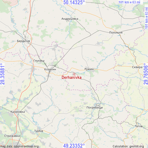
Derhanivka GPS coordinates[2]
49° 41' 25.836" North, 29° 3' 42.948" East
| Map corner | latitude | longitude |
|---|---|---|
| Upper-left | 50.14325°, | 28.35881° |
| Center: | 49.69051°, | 29.06193° |
| Lower-right: | 49.23352°, | 29.76506° |
| Map W x H: | 101.2×101.2 km | = 62.9×62.9mi |
| max Lat: | 52.18903° ⇑22.2% North |
| Derhanivka: | 49.69051° |
| min Lat: | ⇓77.8% South 44.39214° |
| min Long | Derhanivka | max Long |
| 22.20555° | 29.06193° | 40.13222° |
| W 27.7%⇐ | ⇒72.3% E |
Elevation
Elevation of Derhanivka is 225 m = 738 ft, and this is 69.2 m = 227 ft above average elevation for this country.
| Max E: |
886 m = 2907 ft | 25.3% |
| Derhanivka | 225 m 738 ft | |
| Avg. | 155.8 m = 511 ft | |
Min E: |
-3 m = -10 ft | 74.7% |
See also: Ukraine elevation on elevation.city.
Geographical zone
Derhanivka is located in North temperate zone (between Tropic of Cancer and the Arctic Circle). Distance of this North polar circle is 1876.1 km =1165.8 mi to North.| Distance of | km | miles | from Derhanivka |
|---|---|---|---|
| North Pole | 4482 | 2785 | to North |
| Arctic Circle | 1876.1 | 1165.8 | to North |
| Tropic Cancer | 2919.1 | 1813.8 | to South |
| Equator | 5525.1 | 3433.1 | to South |


Nearby cities:
15 places around Derhanivka: (largest is in red/bold)
• Andrushivka
37.1 km =23.1 mi,  355°
355°
• Andrushky
29.4 km =18.3 mi,  43°
43°
• Berdychiv
40.3 km =25 mi,  305°
305°
• Brovky Pershi
28.6 km =17.8 mi,  19°
19°
• Bystriivka
22.2 km =13.8 mi, 41°
• Chervone
32 km =19.9 mi,  334°
334°
• Chornorudka
17.3 km =10.7 mi, 359°
• Golubivka
7.2 km =4.5 mi,  98°
98°
• Hryshkivtsi
42.7 km =26.5 mi, 309°
• Kozyatyn
16.6 km =10.3 mi,  279°
279°
• Pohrebyshche
27 km =16.8 mi,  147°
147°
• Popilnia
40.5 km =25.2 mi, 43°
• Ruzhyn
10.9 km =6.8 mi,  70°
70°
• Topory
18.9 km =11.7 mi, 103°
• Zarudyntsi
10.2 km =6.3 mi,  114°
114°
Sources, notices
• [Note1] Compared only with cities in Ukraine existing in our database
• [Src1] Map data: © OpenStreetMap contributors (CC-BY-SA)
• [Src2] Other city data from geonames.org with taken over terms of usage.
• [Src3] Geographical zone / Annual Mean Temperature by Robert A. Rohde @ Wikipedia
