Andrushky geodata
Andrushky (Zhytomyr) is a seat of a third-order administrative division; located in Ukraine in Europe/Kiev (GMT+3) time zone. In our database, there are 1661 cities with bigger population. Compared to other cities in Ukraine, 81.4% of cities are located further ↓South; 71% of cities are located further →East and 71.5% of cities have lower elevation than Andrushky. Note1


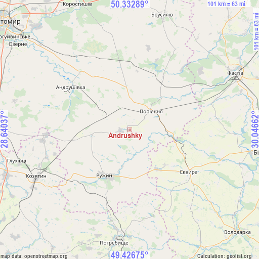
Andrushky GPS coordinates[2]
49° 52' 55.02" North, 29° 20' 36.564" East
| Map corner | latitude | longitude |
|---|---|---|
| Upper-left | 50.33289°, | 28.64037° |
| Center: | 49.88195°, | 29.34349° |
| Lower-right: | 49.42675°, | 30.04662° |
| Map W x H: | 100.8×100.8 km | = 62.6×62.6mi |
| max Lat: | 52.18903° ⇑18.6% North |
| Andrushky: | 49.88195° |
| min Lat: | ⇓81.4% South 44.39214° |
| min Long | Andrushky | max Long |
| 22.20555° | 29.34349° | 40.13222° |
| W 29%⇐ | ⇒71% E |
Elevation
Elevation of Andrushky is 212 m = 696 ft, and this is 56.2 m = 184 ft above average elevation for this country.
| Max E: |
886 m = 2907 ft | 28.5% |
| Andrushky | 212 m 696 ft | |
| Avg. | 155.8 m = 511 ft | |
Min E: |
-3 m = -10 ft | 71.5% |
See also: Ukraine elevation on elevation.city.
Geographical zone
Andrushky is located in North temperate zone (between Tropic of Cancer and the Arctic Circle). Distance of this North polar circle is 1854.8 km =1152.5 mi to North.| Distance of | km | miles | from Andrushky |
|---|---|---|---|
| North Pole | 4460.7 | 2771.7 | to North |
| Arctic Circle | 1854.8 | 1152.5 | to North |
| Tropic Cancer | 2940.4 | 1827.1 | to South |
| Equator | 5546.4 | 3446.4 | to South |


Nearby cities:
15 places around Andrushky: (largest is in red/bold)
• Andrushivka
27.9 km =17.3 mi,  304°
304°
• Brovky Pershi
11.8 km =7.3 mi, 298°
• Buky
22.1 km =13.7 mi,  102°
102°
• Bystriivka
7.2 km =4.5 mi,  228°
228°
• Chornorudka
20.7 km =12.9 mi,  258°
258°
• Derhanivka
29.4 km =18.3 mi,  223°
223°
• Golubivka
25.9 km =16.1 mi,  210°
210°
• Kornyn
27.4 km =17 mi,  30°
30°
• Kozhanka
31.7 km =19.7 mi,  71°
71°
• Kvitneve
17.9 km =11.1 mi,  48°
48°
• Popilnia
11.1 km =6.9 mi,  44°
44°
• Ruzhyn
20.3 km =12.6 mi, 209°
• Skvyra
28.5 km =17.7 mi,  125°
125°
• Topory
25.7 km =16 mi,  184°
184°
• Zarudyntsi
27.8 km =17.3 mi,  203°
203°
Sources, notices
• [Note1] Compared only with cities in Ukraine existing in our database
• [Src1] Map data: © OpenStreetMap contributors (CC-BY-SA)
• [Src2] Other city data from geonames.org with taken over terms of usage.
• [Src3] Geographical zone / Annual Mean Temperature by Robert A. Rohde @ Wikipedia
