Calera geodata
Calera (Oklahoma) is a populated place; located in United States in America/Chicago (GMT-5) time zone. With population of 2,247 people, there are 11224 cities with bigger population in this country. Compared to other cities in United States, 80.7% of cities are located further ↑North; 74.3% of cities are located further →East and 55.4% of cities have lower elevation than Calera. Note1


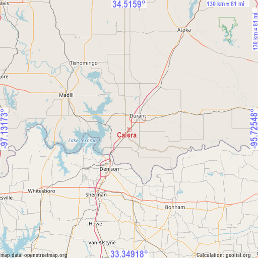
Calera GPS coordinates[2]
33° 56' 4.344" North, 96° 25' 42.96" West
| Map corner | latitude | longitude |
|---|---|---|
| Upper-left | 34.5159°, | -97.13173° |
| Center: | 33.93454°, | -96.4286° |
| Lower-right: | 33.34918°, | -95.72548° |
| Map W x H: | 129.7×129.7 km | = 80.6×80.6mi |
| max Lat: | 71.29058° ⇑80.7% North |
| Calera: | 33.93454° |
| min Lat: | ⇓19.3% South 19.06759° |
| min Long | Calera | max Long |
| -171.73463° | -96.4286° | -66.98998° |
| W 25.7%⇐ | ⇒74.3% E |
Elevation
Elevation of Calera is 220 m = 722 ft, and this is 74.8 m = 245 ft below average elevation for this country.
| Max E: |
3189 m = 10463 ft | 44.6% |
| Avg. | 294.8 m = 967 ft | |
| Calera | 220 m = 722 ft | |
Min E: |
-60 m = -197 ft | 55.4% |
See also: United States elevation on elevation.city.
Geographical zone
Calera is located in North temperate zone (between Tropic of Cancer and the Arctic Circle). Distance of this Northern Tropic circle is 1167.2 km =725.3 mi to South.| Distance of | km | miles | from Calera |
|---|---|---|---|
| North Pole | 6233.9 | 3873.6 | to North |
| Arctic Circle | 3628 | 2254.3 | to North |
| Tropic Cancer | 1167.2 | 725.3 | to South |
| Equator | 3773.2 | 2344.6 | to South |


Nearby cities:
15 places around Calera: (largest is in red/bold)
• Achille
11.9 km =7.4 mi,  161°
161°
• Bells
36.1 km =22.4 mi,  177°
177°
• Bokchito
27.9 km =17.3 mi,  70°
70°
• Caddo
26.2 km =16.3 mi,  35°
35°
• Cartwright
15.3 km =9.5 mi,  233°
233°
• Colbert
11.3 km =7 mi,  217°
217°
• Denison
22.3 km =13.9 mi,  206°
206°
• Durant
8.5 km =5.3 mi, 38°
• Kingston
27.8 km =17.3 mi,  284°
284°
• Madill
36.1 km =22.4 mi,  298°
298°
• Pottsboro
29.6 km =18.4 mi, 228°
• Preston
19.7 km =12.2 mi,  252°
252°
• Savoy
37.7 km =23.4 mi,  171°
171°
• Sherman
37.2 km =23.1 mi, 206°
• Sherwood Shores
37.1 km =23.1 mi,  255°
255°
Sources, notices
• [Note1] Compared only with cities in United States existing in our database
• [Src1] Map data: © OpenStreetMap contributors (CC-BY-SA)
• [Src2] Other city data from geonames.org with taken over terms of usage.
• [Src3] Geographical zone / Annual Mean Temperature by Robert A. Rohde @ Wikipedia
